Pavlopetri Underwater City: The Town That Vanished Beneath the Aegean
A diver hangs three meters below the surface in the warm, glass-clear water off Pounta, the channel that separates the Laconian mainland from the little island of Elafonisos. Below is not reef, not rubble, not the usual scatter of broken pottery that litters the Greek seabed. It is a street. A straight, deliberate street, with the stone footings of buildings rising on either side, doorways opening into courtyards, walls meeting at clean right angles. The diver is looking down at a town — a complete town, laid out exactly as its inhabitants left it, that no human being has walked through in roughly three thousand years.
This is Pavlopetri, and it holds a record nothing else can claim. It is the oldest submerged town ever discovered, predating the famous sunken cities of the classical world by more than a thousand years. While places like Heracleion sank as great ports of the ancient Mediterranean, Pavlopetri was already an old memory before those cities were even built. Its streets were walked by people who lived during the age of the Mycenaean palaces, the world of Bronze Age warriors and traders that later Greeks half-remembered as the time of heroes.
The thing that makes Pavlopetri extraordinary is also the thing that destroyed it. The same slow drowning that erased the town from human memory — no chronicle records it, no legend names it, the very name “Pavlopetri” is modern and borrowed from a nearby islet — also sealed its full plan into the seabed. There was no fire, no eruption, no looting horde. The water rose and the floor of the town quietly subsided, and the place was abandoned and forgotten so completely that for thousands of years no one knew it had ever existed. Erasure and preservation here are the same act. The sea took the town’s life and kept its body.
Bronze Age Laconia: The World Before Pavlopetri Sank
Pavlopetri was founded around 3000 BCE, in the Early Bronze Age, and lived for nearly two thousand years before the sea claimed it sometime around 1000 BCE. That span covers the entire rise and collapse of Mycenaean civilization. The town’s people would have known the world of palace economies, of writing in the script called Linear B, of bronze weapons and long-distance trade across a Mediterranean stitched together by ships.
Laconia, the region around it, was a Mycenaean heartland — the same corner of the Peloponnese that later mythology would attach to Menelaus and Helen of Troy. Pavlopetri sat at a natural crossing point, guarding the narrow channel between the mainland and Elafonisos, with sheltered water on both sides. It was, in modern terms, a harbor town: a place built where the sea routes touched the land.
A Trading Town on the Edge of the Mycenaean World
Pavlopetri made its living from the water that would eventually kill it. The seabed around the buildings is dense with broken storage jars, the heavy ceramic pithoi and transport vessels used to move goods by ship. The sheer quantity of pottery points to a town that handled cargo — oil, wine, grain, textiles — moving between the Peloponnese and the wider Bronze Age trade world that reached toward Crete, the Cycladic islands, and the eastern Mediterranean beyond.
The houses tell the same story. These were not the dwellings of a palace elite but of a busy, middling community of merchants, craftsmen, and laborers. Loom weights found across the site indicate textile production on a domestic scale — cloth spun and woven in the homes, likely traded out through the harbor. Pavlopetri was a working town, not a monument. That ordinariness is exactly why archaeologists prize it. Palaces and citadels survive everywhere in Bronze Age Greece. A complete, intact map of how ordinary people actually arranged their streets and ran their households almost never does.
Life in Pavlopetri: Streets, Houses, and the People Who Lived There
Walk the seabed grid in your mind and the town reassembles itself. A main street runs through the settlement, with smaller lanes branching off it. Buildings cluster in blocks, each one a complex of rooms arranged around an open courtyard — the standard plan of a Bronze Age Aegean house, where domestic life spilled between covered rooms and open-air work space. Some walls survive to enough height that the surveyors could distinguish ground-floor rooms from the footprint of a second storey above. The town had upstairs and downstairs. It had front doors and back rooms, public lanes and private yards.
Stand in one of those courtyards three thousand years ago and the day is loud and ordinary. A woman works a loom weighted with clay rings, the threads catching the Laconian light. Outside, the lane smells of salt and drying fish and the smoke of cooking fires. Down toward the shore, men haul jars from a beached ship, the heavy pithoi passed hand to hand, the harbor crowded with the small craft that connected this place to everywhere. Children move through the lanes between the houses. None of them has any reason to imagine that the ground they are standing on is slowly, imperceptibly, sinking.
The Oldest Planned Town Layout Ever Found Underwater
Pavlopetri’s grid is its great gift to history. Most ancient towns are known only from their most durable buildings — the temple, the citadel, the tomb. The flimsy fabric of daily life, the ordinary houses and the streets between them, rots and is built over and vanishes. At Pavlopetri the streets did not vanish. They were drowned intact and then left alone.
The survey teams mapped at least fifteen separate buildings, a network of streets, and dozens of rock-cut tombs across roughly nine acres of seabed. They could trace which door opened onto which lane, how the blocks of housing fit together, where the public space ended and the private courtyard began. It is, in effect, the floor plan of a complete prehistoric community — the kind of evidence that lets researchers ask not “what did their kings build” but “how did these people actually live, street by street, house by house.” Almost nowhere else in the Bronze Age world does that question have an answer this clear.
The Dead Among the Living: The Cist Graves of Pavlopetri
The town’s dead lay among its living. Scattered across the site are stone-lined cist graves and rock-cut chamber tombs, some set close to the houses, some in clusters that functioned as cemeteries. In the Bronze Age the boundary between the world of the living and the world of the dead was not drawn the way modern cities draw it. The ancestors stayed near.
The graves carry their own quiet human weight. Each cist was cut and lined by people who carried a body to it, who arranged the dead with whatever grave goods the family could spare, who closed the stone and walked back up the lane to their courtyards and their looms. Generations of that — the same rituals, the same short walk from house to tomb — accumulated over nearly two thousand years of habitation. When the sea finally rose, it covered the graves and the houses together, the dead and the living drowned into the same single layer of the seabed. The cemetery that the townspeople tended is now visited only by divers, who pass over the tombs the way the mourners once did, except looking down through three meters of water.
How Pavlopetri Sank: Earthquakes, Rising Seas, and a Drowned Coastline
Pavlopetri sits in one of the most seismically violent regions on the planet. The southern Aegean is where one great slab of the Earth’s crust grinds beneath another, and the result is a coastline that rises and drops in sudden lurches over the centuries. The town was not swallowed in a single dramatic night the way Port Royal was hurled into the sea by the Jamaican earthquake of 1692. Pavlopetri drowned slowly.
The most likely cause is a combination of two forces working together over a long span: the gradual rise of global sea levels since the end of the last Ice Age, and the tectonic subsidence of the Laconian coast itself, dropping in stages with each major earthquake. A series of seismic events around 1000 BCE probably lowered the land enough that the sea moved permanently over the town. There was no single catastrophe to remember, no spectacular destruction to turn into legend. The water just kept coming, and the people left, and the place went under.
That undramatic ending is the reason Pavlopetri is so well preserved. A town destroyed by fire or war is smashed, burned, scavenged for materials, picked over by survivors. A town slowly abandoned to a rising sea is simply walked away from. The residents had time to leave, taking their valuables and their portable lives with them, which is why the site holds humble loom weights and broken jars rather than treasure. What stayed behind was the architecture — the stone footings of the streets and houses, too heavy to carry, left exactly in place to be covered by the water and held there.
Discovery and Mapping: From a 1968 Survey to a Digital Resurrection
Pavlopetri was lost so completely that its rediscovery was almost an accident. In 1967 a geologist named Nicholas Flemming, working on the relationship between ancient sea levels and submerged remains, identified the ruins lying off the Laconian coast. The following year, in 1968, a small team from the University of Cambridge dived the site and produced the first survey, mapping the streets, the buildings, and the tombs. They recognized at once that this was no ordinary scatter of underwater debris but a planned town — and an astonishingly old one.
Then the site went quiet for four decades. The 1968 maps stood as the only record while the seabed and its drowned streets waited, unprotected, in the shallows.
Reading a 3,000-Year-Old Town from the Seafloor
The town came back to life in 2009. A team from the University of Nottingham, working with the Greek archaeological service, returned to Pavlopetri for a five-year project using technology the 1968 divers could only have dreamed of. They mapped the entire site in three dimensions using sonar and stereo-photography, stitching thousands of images into a precise digital model of every wall, street, and grave. The work let them push the town’s founding back to around 3000 BCE and confirm that people had lived there continuously for nearly two thousand years.
The most striking moment came when the digital data was handed to computer-graphics specialists who rebuilt Pavlopetri as it might have looked when it was dry — the courtyards roofed, the second storeys standing, the harbor full of ships. A 2011 BBC documentary brought the reconstruction to a wide audience, and viewers watched a drowned grid of stone footings rise back into a living Bronze Age town. The divers and archaeologists who hovered over the streets had done something rare: they had taken a place erased from human memory and given it back its shape, three thousand years after the last resident locked a door that no longer exists.
Pavlopetri Today: Erosion, Boat Anchors, and a Race Against Time
Pavlopetri’s greatest enemy now is the very accessibility that makes it remarkable. The town lies in only three to four meters of water, close to a popular beach, in a channel crossed constantly by pleasure boats and fishing vessels. The ruins that survived three thousand years of drowning are being steadily ground down by boat anchors dragged across the streets, by careless visitors, and by the natural erosion of currents that move sediment over and off the stones.
The site was added to the World Monuments Fund watch list precisely because of these pressures. The shallow depth that lets snorkelers float over a Bronze Age town with no equipment beyond a mask is the same depth that puts the streets within reach of every anchor chain and curious hand. A place that endured being swallowed by the sea is now threatened by the traffic on its surface. Greek authorities have moved to protect it as an underwater archaeological site, but enforcement across an open stretch of warm, busy coastline is a slow and difficult thing.
There is a bitter symmetry to it. Pavlopetri was preserved precisely because it was forgotten — because for three thousand years no one knew it was there to disturb. The act of rediscovering it, of mapping and filming and publicizing it, is also the act that exposed it to harm. The town that the sea kept safe by hiding is now endangered by being seen.
Visiting Pavlopetri: What Lies Beneath Pounta Beach
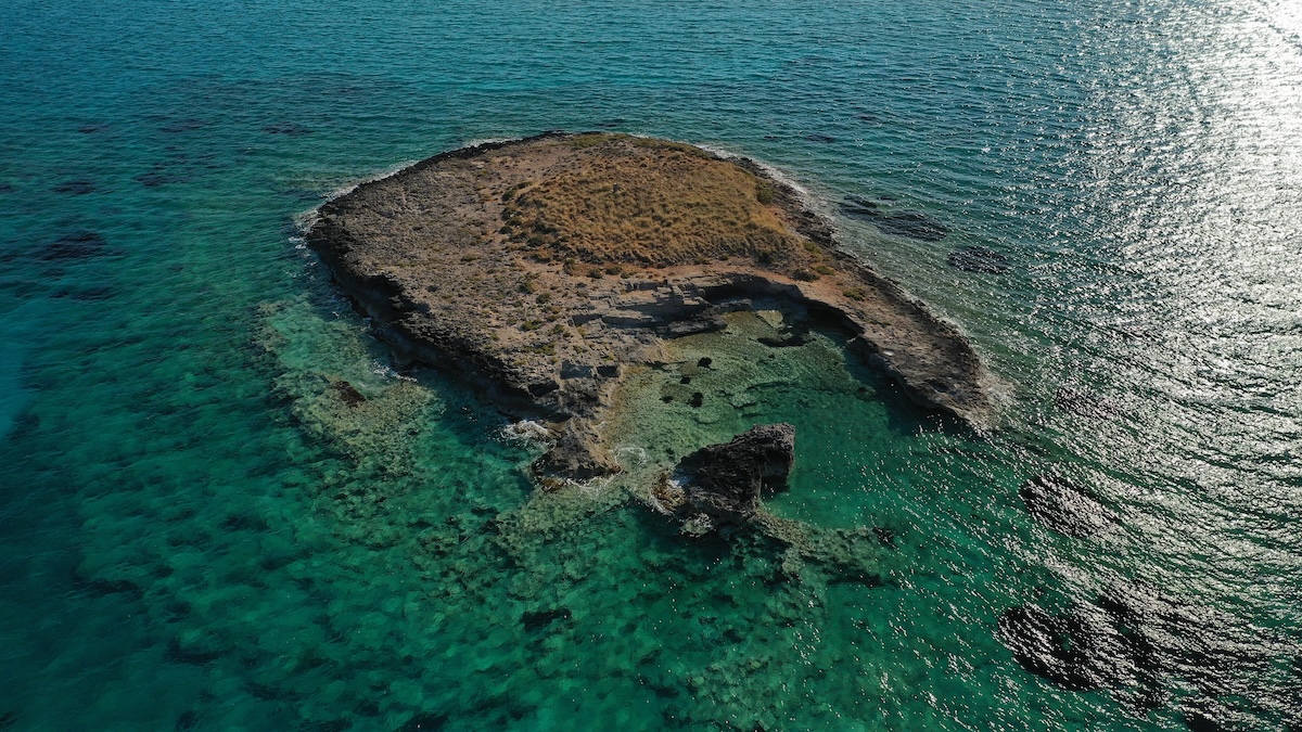
Pavlopetri lies just off Pounta beach, on the Laconian mainland opposite the island of Elafonisos, at the southern tip of the Peloponnese. It is one of the only ancient sunken towns in the world that an ordinary visitor can experience without diving gear. The water is shallow, warm, and exceptionally clear in calm conditions, and the ruins begin only a short swim from shore. A snorkeler floating face-down over the channel can make out the lines of walls, the rectangular footprints of rooms, and the straight runs of street that mark the grid below.
What you will not find is grandeur. There are no columns, no statues, no soaring architecture to photograph. Pavlopetri is humble by design — a working town of merchants and weavers, not a temple complex. Its power is the opposite of spectacle. It is the strangeness of recognizing, three meters down in the blue, the utterly familiar shape of a street, a doorway, a home. The mind insists on populating it: someone lived here, walked here, carried the dead from that house to that grave.
The site is protected, and visitors are asked to look and not touch, to float over the streets without anchoring on them, to treat the seabed as the fragile record it is. Standing — or rather drifting — above Pavlopetri is an exercise in scale. The town is older than Athens, older than Rome, older than almost any name a visitor would recognize. It outlived the entire Mycenaean world and then quietly went under. To hover above its streets is to look directly at the daily life of people three thousand years gone, preserved not by their own monuments but by the sea that erased them. The water took everything they knew and, in doing so, kept the one thing they never thought to leave behind: the shape of their ordinary days.
Frequently Asked Questions About Pavlopetri
What is Pavlopetri and why is it famous?
Pavlopetri is a submerged Bronze Age town lying three to four meters underwater off the coast of southern Laconia in Greece. It is famous for being the oldest submerged town ever discovered, with origins dating back to around 3000 BCE. Unlike most ancient ruins, its complete layout survives intact — streets, courtyards, the foundations of two-storey houses, and dozens of tombs are all still readable on the seabed. This makes it one of the only places on Earth where archaeologists can study the full plan of an ordinary prehistoric community rather than just its grandest monuments.
How old is Pavlopetri?
Pavlopetri was founded around 3000 BCE and was inhabited for nearly two thousand years before the sea claimed it around 1000 BCE. This means it predates the famous sunken cities of the classical Mediterranean by more than a thousand years and was already an ancient site during the height of Mycenaean civilization. Its long span of habitation covers the entire rise and fall of the Bronze Age palace world of Greece.
Why did Pavlopetri sink?
Pavlopetri sank gradually through a combination of rising global sea levels after the last Ice Age and the tectonic subsidence of the Laconian coastline. The southern Aegean is highly seismically active, and a series of earthquakes around 1000 BCE likely lowered the land enough for the sea to move over the town permanently. There was no single dramatic catastrophe — the water simply rose over generations, and the residents abandoned the town and left, which is part of why the site is so well preserved.
Can you visit or dive Pavlopetri?
Pavlopetri is one of the only ancient sunken towns in the world that can be experienced without diving equipment. It lies just off Pounta beach opposite the island of Elafonisos, in water shallow and clear enough that a snorkeler can float over the walls and streets from the surface. The site is a protected underwater archaeological zone, and visitors are asked to look but not touch, and never to anchor over the ruins, which are fragile and easily damaged.
Who discovered Pavlopetri?
The submerged ruins were identified in 1967 by the geologist Nicholas Flemming, and the first survey was carried out in 1968 by a team from the University of Cambridge. The site was then left largely undisturbed for four decades until a major five-year project began in 2009, led by the University of Nottingham in cooperation with the Greek archaeological service. That project mapped the entire town in three dimensions and produced a digital reconstruction that featured in a 2011 BBC documentary.
What was life like in Pavlopetri?
Pavlopetri was a working harbor town of merchants, craftsmen, and laborers rather than a palace or elite center. The dense scatter of storage and transport jars on the seabed shows it handled cargo moving by ship, while clay loom weights found across the site indicate textile production in the homes. People lived in courtyard houses, some with second storeys, arranged along a grid of streets, and they buried their dead in stone-lined cist graves and rock-cut tombs set close among the living.
Sources
Pavlopetri: An Underwater Bronze Age Town in Laconia — Jon Henderson, University of Nottingham (2011)
The Pavlopetri Underwater Archaeology Project — Jon Henderson, Chrysanthi Gallou, Nicholas Flemming, et al., Annual of the British School at Athens (2011)
Archaeological Evidence for Eustatic Change of Sea Level and Earth Movements in the Western Mediterranean — Nicholas C. Flemming, Geological Society of America (1969)
Submarine Survey in the Bay of Pavlopetri — Nicholas C. Flemming & Antony Harding, British School at Athens (1969)
Mycenaean Greece: A Guide to the Bronze Age Aegean — Louise Schofield, British Museum Press (2007)
The Mycenaeans — Rodney Castleden, Routledge (2005)
Sea Level Change and the Submerged Town of Pavlopetri — Chrysanthi Gallou, British School at Athens (2011)
City Beneath the Waves: Pavlopetri — BBC Two / Atlantic Productions (2011)
Underwater Cultural Heritage in the Mediterranean — UNESCO (2017)
Pavlopetri Site Report — World Monuments Fund Watch (2010)