Why Korea Was Divided at the 38th Parallel
The Pentagon, late on the night of August 10, 1945. Two Army colonels — Dean Rusk and Charles "Tic" Bonesteel — stand over a National Geographic map of the Korean peninsula spread across a table in an adjacent room they've commandeered for the task. Both are Rhodes Scholars. Neither knows anything about Korea. Soviet tanks have been rolling through Manchuria for two days. Soviet marines have already landed at Wonsan. The nearest American troops are six hundred miles away on Okinawa, and if Washington doesn't propose a dividing line within hours, there will be nothing to divide — the Soviets will take the whole peninsula. Rusk and Bonesteel scan the map for a line. Not a historically meaningful one. Not a geographically rational one. Just a line that keeps Seoul on the American side. The 38th parallel bisects the peninsula roughly in half. Seoul sits just below it. Rusk later admitted the line "made no sense economically or geographically." They proposed it anyway. The Soviets accepted with surprising ease. It was supposed to be temporary.
Korea had been one nation since the seventh century — over a thousand years of shared language, shared cuisine, shared Confucian social order. The 38th parallel cut through no mountain range, no river, no administrative boundary. It followed no ethnic divide. It was a line of latitude chosen in thirty minutes by two men working from a magazine map because they needed a line and didn't have time to find a better one.
Eighty years later, it is the most fortified border on the planet. What Rusk and Bonesteel drew that night became a three-year war that killed an estimated 2.5 million people, a seven-decade frozen conflict, and the sharpest ideological fault line remaining on Earth. The 38th parallel is a monument to the most dangerous assumption in geopolitics: that temporary solutions stay temporary. They never do.
Korean History Before the Division: 1,300 Years as One Nation
Japanese Colonial Rule in Korea and the Rise of Rival Movements (1910–1945)
Korea's unity was not an abstraction. The peninsula had existed as a single political and cultural entity for over a millennium — from the Unified Silla dynasty in 668 AD through the Goryeo and Joseon dynasties, the latter lasting five centuries until Japan formally annexed the country in 1910. Korean language, customs, and identity were shared across every latitude the 38th parallel would later bisect.
Japan's 35-year colonial occupation was systematic erasure. Korean language was suppressed in schools. Korean names were forcibly replaced with Japanese ones under the sōshi-kaimei policy. Hundreds of thousands of Koreans were conscripted as forced laborers in Japanese mines and factories; tens of thousands of women were coerced into sexual slavery as so-called "comfort women" for the Imperial Japanese Army — a crime whose survivors would spend decades fighting for acknowledgment, many dying before it came.
Resistance fractured along lines that would prove catastrophic. Communist guerrillas, many based in Manchuria and backed by the Soviet Union, fought the Japanese from the north. Kim Il-sung emerged from this tradition — a young partisan leader who had spent years in Soviet-controlled territory. Nationalist exiles, meanwhile, organized in Shanghai and the United States, building a provisional government-in-exile under leaders like Kim Gu and the American-educated Syngman Rhee. The two strands of Korean resistance — communist and nationalist, Soviet-aligned and American-aligned — were already diverging long before anyone drew a line on a map. Japan's colonial project had failed to erase Korean identity. It had succeeded in fracturing Korean politics.
The Partition of Korea: How a Temporary Line Became Permanent
Soviet and American Occupation Zones in Korea (1945–1948)
The Soviets accepted Rusk and Bonesteel's proposed line and began consolidating control of the north immediately. On September 8, 1945, American forces under Lieutenant General John R. Hodge landed at Incheon to begin their occupation of the south. The agreement was incorporated into General Order No. 1 for Japan's surrender — a document that treated Korea not as a nation being liberated, but as a piece of the Japanese empire being administratively divided between victors.
The original plan — a five-year international trusteeship leading to unified self-governance — collapsed almost immediately. Cold War suspicion made genuine cooperation between Washington and Moscow impossible. A Soviet-American Joint Commission met in 1946 and again in 1947 and went nowhere. By May 1946, crossing the 38th parallel without a permit had already been made illegal. The temporary occupation line was hardening into something permanent, and no one on either side had the political will to stop it. Sixteen million Koreans found themselves in the American zone. Nine million were in the Soviet zone. Families that had lived as neighbors for generations discovered they were now on opposite sides of an increasingly impenetrable border.
North Korea and South Korea: Two Governments, One Peninsula
In 1948, the fiction of a temporary division gave way to permanent rupture. The United Nations, blocked by Soviet objections from holding peninsula-wide elections, oversaw a vote only in the south. On August 15, 1948, the Republic of Korea was declared, with Syngman Rhee as its first president. Three weeks later, on September 9, the Democratic People's Republic of Korea was proclaimed in the north, with Kim Il-sung installed as premier.
Both governments claimed sovereignty over the entire peninsula. Both considered the other illegitimate. Both were authoritarian — Rhee's regime in the south executed thousands of suspected leftists in the years before the war, a fact that would be suppressed for decades. The 38th parallel was no longer a line between occupation zones. It was a border between two rival states, each armed by a superpower, each convinced the other had no right to exist. The question was not whether the line would hold. It was who would cross it first.
The Korean War (1950–1953): The Forgotten War That Killed Millions
North Korea's Invasion of South Korea (June 1950)
At 4:00 a.m. on June 25, 1950, approximately 75,000 North Korean soldiers crossed the 38th parallel behind a curtain of artillery fire. The invasion caught South Korea, the United States, and the United Nations almost completely off guard. South Korean forces — poorly trained, lightly armed, and widely assessed by American advisers as unready for war — crumbled within days. Seoul fell in three days. Within weeks, South Korean and hastily deployed American forces had been pushed into a tiny defensive perimeter around the southeastern port city of Pusan, their backs to the sea.
The speed of the collapse was staggering. Entire South Korean divisions disintegrated. Refugees clogged the roads south, slowing military movements and creating scenes of desperate chaos — families carrying everything they owned on their backs, children separated from parents in the crush, columns of civilians strafed by aircraft overhead. American soldiers, many of them garrison troops from occupation duty in Japan with no combat experience, found themselves fighting a well-equipped North Korean army trained and armed by the Soviet Union. The Checkpoint Charlie standoffs of the Cold War would later become the iconic image of superpower confrontation in Europe — but in Asia, the confrontation was not symbolic. It was measured in body counts.
The Battle of Inchon and MacArthur's Push to the Yalu River
General Douglas MacArthur's amphibious landing at Inchon on September 15, 1950, was one of the most audacious operations in modern military history. Tidal variations of over 30 feet, narrow approach channels, and fortified seawalls made the landing site so improbable that the North Koreans had left it lightly defended. The gamble worked. Within two weeks, Seoul was recaptured. North Korean supply lines were severed. The invading army, trapped between the Inchon beachhead and the Pusan perimeter, collapsed.
MacArthur did not stop at the 38th parallel. Authorized by the UN to restore peace and stability — language he interpreted as broadly as possible — he pushed north toward the Yalu River, the border with China. It was the decision that transformed a successful counterattack into a catastrophe. MacArthur assured President Harry Truman at their Wake Island meeting in October that the Chinese would not intervene. He was spectacularly wrong.
China's Entry into the Korean War and the Battle of Chosin Reservoir
On the night of November 25, 1950, approximately 300,000 Chinese soldiers — People's Volunteer Army troops who had infiltrated across the Yalu under cover of darkness and mountainous terrain — struck the overextended UN lines. The shock was total. At the Chosin Reservoir, 30,000 UN troops — mostly U.S. Marines and soldiers of the 7th Infantry Division — found themselves encircled by 120,000 Chinese forces in temperatures plunging to minus 35 degrees Fahrenheit. Weapons froze solid. Morphine syrettes had to be thawed in medics' mouths before they could be injected into the wounded. Blood plasma froze in the IV bags. Marines carved firing positions into ground so hard that entrenching tools shattered on contact.
The 78-mile fighting retreat to the port of Hungnam became the longest withdrawal in American military history. The Marines carried their dead and wounded through mountain passes choked with snow and ambushes, refusing to leave anyone behind. At Hungnam, the evacuation fleet took aboard not only 105,000 soldiers but 98,000 Korean civilians — the SS Meredith Victory alone carried 14,000 refugees, the largest rescue operation by a single ship in history, on a vessel designed for twelve passengers.
Seoul changed hands for the third time in January 1951 as Chinese and North Korean forces pushed south. The war that MacArthur had declared all but won in October had, by January, returned to roughly the same line where it started. The remaining two years were a grinding, static bloodbath along entrenched positions, more reminiscent of the Verdun trenches of 1916 than the mobile warfare of World War II. By the time the guns fell silent, an estimated 2.5 million people — soldiers and civilians — were dead.
The Korean War Armistice: Why No Peace Treaty Was Ever Signed
Negotiations began in July 1951 at Kaesong, then moved to Panmunjom. They would drag on for two years — longer than the mobile phase of the war itself — while soldiers continued dying along the static front line. The central dispute was prisoner repatriation: thousands of Chinese and North Korean POWs refused to return home, and the UN Command would not force them. The argument over individual human beings became a proxy for the ideological war itself.
On July 27, 1953, the Korean Armistice Agreement was signed at Panmunjom by representatives of the UN Command, the Korean People's Army, and the Chinese People's Volunteer Army. South Korean President Syngman Rhee refused to sign — he wanted to continue fighting until the peninsula was unified under his rule. The agreement established the Military Demarcation Line (MDL) along the actual front line, which zigzagged roughly along the 38th parallel but diverged significantly in places. A four-kilometer-wide buffer zone — the Demilitarized Zone — was created on either side of the MDL, stretching 250 kilometers from coast to coast.
The armistice was explicitly a ceasefire, not a peace treaty. It was designed to hold until a political settlement could be reached. That settlement never came. The "temporary" ceasefire has now outlasted the Soviet Union, the Berlin Wall, and the Cold War that created it.
The Axe Murder Incident at Panmunjom (1976)
The Joint Security Area (JSA) at Panmunjom is the only point along the entire DMZ where North and South Korean forces stand face to face. A row of low blue conference buildings straddles the MDL. Inside, a conference table sits exactly on the line — one end is North Korea, the other is South Korea. Soldiers from both sides stand motionless, staring at each other across a distance measured in feet.
On August 18, 1976, this strip of ground nearly reignited the Korean War — over a tree. A team of UN Command personnel entered the JSA to trim a poplar that was blocking the line of sight between a checkpoint and an observation post. Captain Arthur Bonifas and First Lieutenant Mark Barrett led the party. Neither carried a weapon — JSA regulations limited arms inside the area. Bonifas was three days from rotating home to his family.
A group of fifteen North Korean soldiers arrived, led by Senior Lieutenant Pak Chul, known to the Americans as "Lieutenant Bullfrog." Pak demanded the trimming stop, claiming Kim Il-sung had personally planted the tree. Bonifas ignored him. Pak sent a runner across the Bridge of No Return. Within minutes, a truck carrying twenty more North Korean soldiers armed with crowbars and clubs rumbled across the bridge. Pak demanded again. Bonifas turned his back. Then Pak did something that the soldiers watching from the observation posts would never forget: he carefully removed his wristwatch, wrapped it in a handkerchief, placed it in his pocket, and shouted, "Kill the bastards!"
The North Koreans seized the pruning axes the workers had dropped. The fight lasted thirty seconds. Bonifas was knocked to the ground and bludgeoned to death by at least five men. Barrett leaped over a retaining wall into a shallow depression beyond the road — where, for the next ninety minutes, North Korean soldiers took turns going down with an axe and coming back up. UNC guards in the observation post watched the rotation without initially understanding what they were seeing. Barrett was found alive. He died on the helicopter to Seoul.
Three days later, the United States launched Operation Paul Bunyan. The mission: cut down the poplar tree. The force: 813 men, 23 vehicles, seven Cobra attack helicopters, B-52 bombers circling overhead, a carrier battle group positioned offshore, and 64 South Korean Special Forces soldiers — some of whom had strapped claymore mines to their chests and were daring the North Koreans to come closer. Engineers felled the tree in forty-two minutes. They left a deliberate twenty-foot stump. The camp at the JSA was renamed Camp Bonifas.
North Korean Tunnels and DMZ Defections
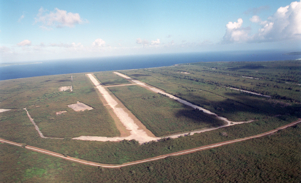
The DMZ's history is punctuated by intrusions, provocations, and escapes that have kept both sides in a permanent state of hyper-vigilance. Since 1974, South Korea has discovered four infiltration tunnels dug beneath the DMZ by North Korea — passages bored through solid granite, large enough to move thousands of troops per hour. The third tunnel, discovered in 1978, ran directly toward Seoul, just 44 kilometers away. North Korea claimed each one was a coal mine, despite the fact that the tunnels contained no coal. Officials had painted the walls black in an attempt to simulate coal deposits.
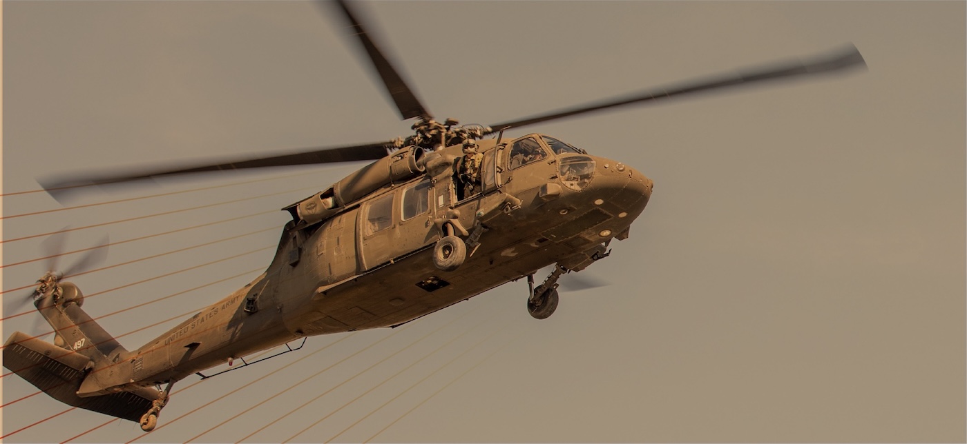
The most dramatic defection of the modern era lasted less than a minute. On November 13, 2017, Oh Chong-song, a 24-year-old North Korean soldier and the son of a major general, drove a military jeep at high speed directly at the MDL. The surveillance cameras captured everything. The jeep tore past a North Korean checkpoint. Oh's own comrades scrambled after him. The vehicle crashed into a ditch meters from the line. Oh leaped out and ran — sprinting between two trees, across open ground, directly toward South Korea. Behind him, North Korean soldiers dropped to firing positions and opened up.
Five bullets hit him. One tore through his shoulder, blowing apart the muscle underneath his padded jacket. He kept running. He collapsed behind a low concrete wall on the South Korean side, blood pooling beneath him. South Korean soldiers crawled to him through the grass and dragged him to cover. He was airlifted by a U.S. Black Hawk to a trauma center in Suwon, where surgeon Lee Cook-jong found that Oh had lost nearly half his blood — seven organs ruptured, his body described as leaking "like a broken jar." And when Lee opened him up, he found something else: parasitic worms, one measuring 27 centimeters, infesting Oh's intestines — a consequence of North Korea's use of human feces as agricultural fertilizer. The worms told a story that the propaganda village across the DMZ was designed to hide.
Oh survived. When he regained consciousness days later, his first words to the surgeon were: "Is this the South?"
In an interview eighteen months later, Oh was asked whether he blamed his former comrades for shooting him. "In their situation I would have fired the gun," he said. "It's not a matter of friendship."
Korean DMZ Wildlife: The Accidental Nature Reserve
Endangered Species Thriving Inside the DMZ's Minefields
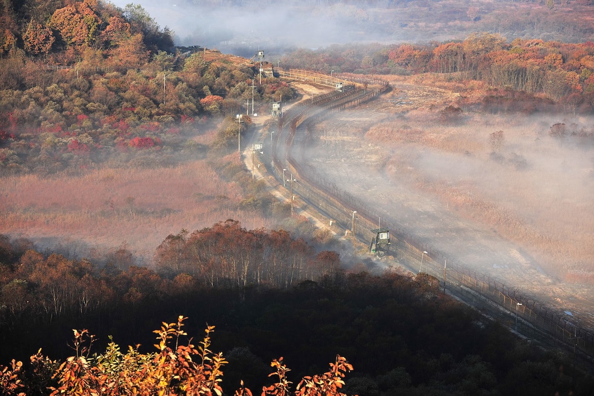
Seven decades of human absence have produced one of the most extraordinary ecological stories on Earth — and one of its darkest ironies. The DMZ is a landscape designed to kill. Over a million landmines are buried in its soil. Anti-tank barriers line its approaches. Concertina wire stretches from coast to coast. Guard towers scan every meter of ground. And yet, because no farmer has plowed this soil since 1953, no developer has broken ground, no highway has been laid — the most militarized border on the planet has become the most pristine temperate habitat in Asia.
The numbers alone are remarkable. According to South Korea's National Institute of Ecology, nearly 6,200 wildlife species have been identified within the DMZ and its surrounding buffer areas. Of the 267 endangered species on the Korean peninsula, 102 live inside the zone. Seven of the world's fifteen crane species are found there, including the endangered red-crowned crane and the white-naped crane — birds whose global survival may depend on a ceasefire between two nations that have been pointing guns at each other for seven decades.
The red-crowned crane — one of the rarest birds on the planet, with roughly 3,000 left in the wild — winters in the DMZ's wetlands, feeding on spent grain left in rice paddies within the Civilian Control Zone, sleeping in the silence of the minefields where no human foot disturbs them. Asiatic black bears have been spotted on camera traps moving through forests that have been regenerating since the last shell fell. Siberian musk deer, long-tailed gorals, and leopard cats inhabit the eastern mountain ranges. There are persistent, unconfirmed reports of Amur leopards and even Siberian tigers surviving in the deeper forests — animals that have been functionally extinct elsewhere on the peninsula for decades.
The parallel to the Chernobyl Exclusion Zone is precise and haunting. At Chernobyl, wolves, wild horses, and European bison now roam through an irradiated landscape that killed dozens of people and displaced hundreds of thousands. At the DMZ, cranes nest among anti-tank barriers and deer graze on land seeded with explosives. Both places tell the same brutal truth: the most dangerous thing in any ecosystem is not radiation, not landmines, not chemical contamination. It is us. Remove humans from a landscape — for whatever reason — and life comes back. It comes back through minefields. It comes back through fallout zones. It comes back through the most heavily armed border on Earth. The wildlife of the DMZ is not thriving despite the military standoff. It is thriving because of it.
Author Alan Weisman, whose book The World Without Us explored what would happen to the planet if humans vanished, called the DMZ the best place on Earth to see the answer. "If you want to know what the world would look like if humans suddenly disappeared," he wrote, "the DMZ would be a good first place to look."
What Happens to DMZ Wildlife If Korea Reunifies?
The conservation dilemma is exquisite and unresolvable. Director Kim Seung-ho of the DMZ Ecology Research Institute has spent nearly two decades documenting the zone's wildlife, walking its restricted edges every weekend, and he is blunt about the threat that comes not from war but from peace. Every time inter-Korean relations warm — every summit, every handshake, every declaration of goodwill — development proposals follow immediately: railways through the DMZ, highways connecting North and South, industrial zones in the buffer area. Kim has watched it happen through multiple diplomatic cycles. "When inter-Korean relations improve, development pressure intensifies," he has said. "Environmental conservation is rarely treated as a top-tier priority, regardless of the situation."
The DMZ's wildlife depends on the continuation of a conflict that has caused immeasurable human suffering. The cranes need the mines. The bears need the wire. The forest needs the guns to keep the bulldozers out. No conservationist would choose to protect a habitat this way. No one designed it. And no one has a plan for what happens to 6,200 species if the two Koreas ever sign the peace treaty that has been pending since 1953.
Kijŏng-dong: North Korea's Fake Propaganda Village in the DMZ
Two villages sit within the DMZ, directly facing each other across a mile of minefields — two competing visions of Korean life staged for an audience of soldiers with binoculars.
On the South Korean side: Daeseong-dong, known as "Freedom Village." Roughly 138 residents live there, all descendants of families who farmed this land before the war. They work some of the most valuable agricultural plots in South Korea, are exempt from taxes and military service, and live under an 11:00 p.m. curfew enforced by the military. The village elementary school, lavishly funded by the government as a showpiece, educates six students per class — most bused in from outside the DMZ. The Military Demarcation Line runs 350 meters from the nearest house.
On the North Korean side: Kijŏng-dong, which Pyongyang calls "Peace Village" and which the rest of the world calls "Propaganda Village." From a distance, through the haze, it looks like a prosperous small town — brightly painted multi-story buildings, a hospital, a school, electric lights glowing at night. Through binoculars, the illusion disintegrates. The buildings are concrete shells with no interior rooms. The windows have no glass — some are painted on. The lights switch on and off by automatic timers. No one lives there. No one has ever lived there. The entire settlement was constructed in the 1950s as a Potemkin village designed to project North Korean prosperity and lure South Korean defectors. Not a single one ever came.
The two villages spawned one of the Cold War's most absurd competitions. In the 1980s, South Korea erected a 100-meter flagpole in Daeseong-dong. North Korea responded with a 160-meter flagpole in Kijŏng-dong — at the time, the tallest in the world — flying a flag that weighed 270 kilograms dry and considerably more in the rain. For decades, both sides mounted massive loudspeakers on their respective buildings and blasted propaganda across the DMZ: North Korea broadcasting revolutionary operas, anti-Western speeches, and patriotic marching music up to twenty hours a day; South Korea countering with news, weather forecasts, and — in a stroke of psychological warfare that infuriated Pyongyang — K-pop. The loudspeaker war was suspended in 2018. The silence that replaced it is, in its own way, more unsettling than the noise.
Visiting the Korean DMZ: The Atlas Entry
How to Visit the Korean DMZ and Joint Security Area from Seoul
The DMZ is accessible only through organized tours departing from Seoul, typically lasting a full day. Most tours visit the Third Infiltration Tunnel — where visitors descend into a narrow, dripping passage bored through granite by North Korean engineers and walk toward a concrete barricade that marks the point beyond which lies North Korea — as well as the Dora Observatory, which offers views across the DMZ toward Kijŏng-dong and its colossal flagpole, and Dorasan Station, a gleaming modern railway terminal built in 2002 as a symbol of future reunification. Departure boards list trains to Pyongyang. No train has ever departed.
The Joint Security Area at Panmunjom — where visitors could once step across the MDL into the North Korean side of the conference room — has been subject to intermittent closures and heightened restrictions, particularly following escalating border incidents. Tours require advance booking, passport registration, and adherence to a strict dress code. Visitors are briefed that their safety cannot be guaranteed. This is not a formality.
Imjingak Peace Park, located just south of the DMZ, is more freely accessible. The park's most affecting site is the Bridge of Freedom — a wooden bridge over which 12,773 Korean War POWs walked south after the armistice. Beside it, hundreds of ribbons are tied to the chain-link fence by South Koreans who have never been permitted to visit relatives in the North. The ribbons carry handwritten messages to parents, siblings, and children separated for seventy years. Many are addressed to people who are almost certainly dead.
What It's Like to Stand at the Korean Border
The first thing that strikes visitors at the DMZ is the silence. The second is the beauty. The hills beyond the fence are green, unbroken, empty — one of the last stretches of Korean landscape that looks the way it did before industrialization reshaped the peninsula. Barbed wire and guard towers seem almost incongruous against the soft contours of the terrain. Then a bird lifts from the wetland beyond the wire — a white-naped crane, perhaps, or a black-faced spoonbill — and the strangeness of the place sharpens into focus. That bird is alive because this ground is too dangerous for humans to walk on.
The emotional weight arrives differently for different visitors. For foreign tourists, the DMZ is a relic — a Cold War artifact preserved in amber, bizarre and fascinating. For Korean visitors, it is something else entirely. South Korea's Ministry of Unification estimates that more than 100,000 South Koreans are still registered as members of separated families — people with living relatives in the North whom they have never been allowed to contact. Most are in their eighties and nineties. Every year, more of them die without reunion. The ribbons on the fence at Imjingak are not history. They are grief, ongoing and unresolved, pinned to wire.
The 38th parallel was never supposed to exist. Two men drew it in thirty minutes because they needed a line and didn't have time to find a better one. The ceasefire still holds. The peace never came. And in the silence between the fences, where the cranes winter and the deer graze on mined ground, the land itself has moved on — indifferent to the argument that created it, already becoming something new.
FAQ
What is the 38th parallel and why is it significant?
The 38th parallel is the line of latitude that was used to divide Korea into Soviet and American occupation zones at the end of World War II in 1945. Two U.S. Army colonels, Dean Rusk and Charles Bonesteel, selected it using a National Geographic map because it roughly divided the peninsula in half while keeping the capital, Seoul, in the American zone. The line had no historical, cultural, or geographic significance to Korea. It became the basis for the division of the country into North and South Korea, and the Korean War was fought largely along this line. The current border, the Military Demarcation Line within the Demilitarized Zone, roughly follows the 38th parallel but diverges in several places.
How many people died in the Korean War?
Estimates vary, but the Korean War is believed to have killed approximately 2.5 million people between 1950 and 1953. This includes an estimated 1.5 to 3 million Korean civilians on both sides, roughly 137,000 South Korean military personnel, several hundred thousand North Korean soldiers, and significant Chinese losses. The United States lost 36,574 service members. The war is often called "the Forgotten War" because it was overshadowed by World War II before it and the Vietnam War after it, despite being one of the deadliest conflicts of the twentieth century.
Can you visit the DMZ and the Joint Security Area?
The DMZ can be visited through organized tours departing from Seoul, typically lasting a full day. Most tours include sites such as the Third Infiltration Tunnel, Dora Observatory, and Dorasan Station. The Joint Security Area at Panmunjom has historically been open to visitors but is subject to intermittent closures and strict security protocols. Visitors must book in advance, register passports, and follow a dress code. Imjingak Peace Park, located just south of the DMZ, is more freely accessible and does not require a tour group.
Why is the Korean DMZ important for wildlife?
Over seven decades of human absence have turned the DMZ into an accidental nature reserve. Nearly 6,200 species have been identified in the zone, including 102 of the 267 endangered species on the Korean peninsula. The area supports populations of red-crowned cranes, Asiatic black bears, Siberian musk deer, and other rare animals. The DMZ spans 250 kilometers across the peninsula and encompasses wetlands, forests, grasslands, and mountain habitats. The ecological parallel to the Chernobyl Exclusion Zone is striking — both are places where human catastrophe accidentally created wildlife sanctuaries, suggesting that the most damaging force in any ecosystem is not contamination or conflict but sustained human presence.
What was the axe murder incident at the DMZ?
On August 18, 1976, North Korean soldiers killed two U.S. Army officers — Captain Arthur Bonifas and First Lieutenant Mark Barrett — in the Joint Security Area at Panmunjom. The officers had been supervising a work party trimming a poplar tree that blocked UN observation lines. A North Korean officer, Senior Lieutenant Pak Chul, ordered the attack after the Americans refused to stop the trimming. Three days later, the U.S. launched Operation Paul Bunyan, deploying hundreds of troops backed by attack helicopters and B-52 bombers to cut the tree down in a massive show of force. The advance camp at the JSA was renamed Camp Bonifas in honor of the slain captain.
Is there still a war between North and South Korea?
Technically, yes. The Korean War ended with an armistice on July 27, 1953, not a peace treaty. The armistice established a ceasefire and created the Demilitarized Zone, but the two countries remain in a state of war. South Korean President Syngman Rhee refused to sign the armistice, and no subsequent peace agreement has been reached. Periodic diplomatic efforts — including summits between North and South Korean leaders in 2000, 2007, and 2018 — have produced declarations of intent but no formal peace treaty. The DMZ remains one of the most heavily militarized borders in the world.
Sources
- [As I Saw It] — Dean Rusk with Richard Rusk (1991). Memoir detailing the night of August 10, 1945 and the decision to divide Korea at the 38th parallel.
- [The Korean War: A History] — Bruce Cumings, Modern Library (2010). Comprehensive history of the origins, conduct, and legacy of the Korean War.
- [The Coldest Winter: America and the Korean War] — David Halberstam, Hyperion (2007). Narrative history of the Korean War with focus on the Chosin Reservoir campaign and Chinese intervention.
- [National Geographic, Korea, and the 38th Parallel] — National Geographic Society (2013). Analysis of the role of National Geographic cartography in the division of Korea.
- [This Kind of War: The Classic Korean War History] — T.R. Fehrenbach, Potomac Books (1963, reissued 2001). Military history of the Korean War from the American perspective.
- [Korean Axe Murder Incident: Operation Paul Bunyan] — U.S. Army War College analysis (1977). Declassified military assessment of the 1976 JSA incident.
- [Axes of Evil] — The Atavist Magazine (2018). Long-form account of the 1976 axe murder incident drawing on military records and survivor interviews.
- [DMZ Ecology Research Institute Field Reports] — Kim Seung-ho et al. (2019–2024). Biodiversity surveys of the Korean DMZ and Civilian Control Zone.
- [In Korean DMZ, Wildlife Thrives] — NPR (2019). Field reporting on the ecological significance of the DMZ and conservation concerns.
- [The Accidental Nature Preserve of the DMZ] — JSTOR Daily (2025). Analysis of the DMZ as an unintentional wildlife corridor.
- [Britannica: Korean War] — Allan R. Millett, Encyclopaedia Britannica (updated 2026). Reference overview of the war's origins, conduct, casualties, and aftermath.