Lagos Slave Trade History: A Megacity Built on a Coastline of Ghosts
Modern Lagos is a sensory assault of exhaust, high-decibel commerce, and the relentless churning of the Atlantic. It is a city that screams to drown out its own history. Underneath the glass towers of Victoria Island and the sprawling shipping containers of Apapa lies a coastal geography that was once defined by a different kind of commodity. To stand on the shoreline today is to feel the weight of a maritime system that treated human beings as ballast.
The Lagos Coast was never just a collection of random villages; it was a highly sophisticated, interconnected network of lagoons and inland waterways designed for the movement of people. While the modern traveler sees the glittering skyline of the city, the historical truth is anchored forty miles to the west in the town of Badagry. This coastline functioned as a singular organism. Lagos provided the political and naval muscle, while Badagry served as the specialized holding cell.
You cannot understand the tragedy of the Nigerian slave trade by looking at Lagos alone. The city has eaten its history, paving over the barracoons with highways and luxury apartments. To see the scars, you must follow the water westward along the coast. The story of this region is the story of a Point of No Return that began in the quiet lagoons of the interior and ended in the churning surf of the bight. This is a journey through a landscape where the architecture of displacement is still visible in the crumbling bricks of the colonial houses and the silent, salt-sprayed beaches of the Gberefu Peninsula.
Understanding the Geography: Lagos City vs Badagry Heritage Sites
Confusion often arises when discussing the Lagos slave trade because the modern map of Lagos State has swallowed the distinct historical identities of its constituent parts. To understand the narrative that follows, one must distinguish between Lagos City and the town of Badagry. While both exist within the administrative borders of Lagos State today, they played two different, yet complementary, roles in the Atlantic trade.
Badagry is the physical archive. Located roughly 60 kilometers west of the Lagos city center, it is a town of weathered monuments and surviving structures. It was here that the majority of the coastal holding cells—the barracoons—were constructed. Because Badagry did not experience the explosive, vertical urban growth of Lagos city, its historical sites remain largely intact, offering a visceral, tactile connection to the 18th and 19th centuries.
Lagos City, conversely, was the power hub. Originally an island settlement (Eko), it sat at the mouth of a massive lagoon system that allowed it to control all trade coming from the interior of West Africa. Lagos was the gatekeeper. While the "dirty work" of long-term human storage often happened in the quieter reaches of Badagry, the financing, the high-level political negotiations with European powers, and the naval logistics were centered in Lagos.
This article treats the Lagos Coast as a unified historical entity. We move from the administrative coldness of the Lagos ports to the harrowing physical reality of the Badagry slave route. To separate them is to misunderstand how the system worked: Lagos was the mind of the operation; Badagry was its brutal, functional hand.
The West African Coastline: Geography of the Atlantic Slave Trade
The Strategic Trap of the Lagos Lagoons
The geography of the Lagos Coast was a natural gift to the 18th-century merchant and a death sentence for the captive. Before the arrival of the Portuguese, the region was defined by a massive network of interconnected lagoons that ran parallel to the Atlantic Ocean. These waters provided a "backdoor" highway that stretched hundreds of miles. This allowed local traders to move captives via canoe through calm, hidden waters, shielded from the unpredictable currents and the prying eyes of rival coastal groups.
Coastal Elites and the Rise of the Middleman
By the late 1700s, the Lagos Coast had transitioned from a fishing and salt-producing backwater into a specialized trade zone. The local leadership—the Obas of Lagos and the Akran of Badagry—found themselves navigating a dangerous geopolitical landscape. The Atlantic trade was not a simple binary of "Europeans vs. Africans"; it was a complex economic ecosystem where local elites leveraged European demand for labor to consolidate their own regional power. Human beings became the currency used to purchase the very weapons needed to capture more human beings.
The Architecture of the Shore and Surf Boatmen
The shoreline itself was a barrier. Unlike the deep-water ports of Europe, the Lagos Coast was guarded by a treacherous sandbar. Large European ships had to anchor miles out at sea, bobbing in the violent Atlantic surf. This created a lucrative sub-industry for the coastal inhabitants of Lagos and Badagry: the surf-boatmen. These men navigated small, unstable vessels through the crashing waves to ferry "cargo" from the calm lagoons to the waiting ships, creating a logistical bottleneck where every human life passed through the hands of a dozen different specialists.
Visiting Badagry: Where the Slave Port Architecture Remains
The Barracoons of Seriki Abass and Mobee Family
In the heart of Badagry, the Seriki Abass Slave Museum stands as a testament to the clinical nature of the trade. Originally a Brazilian-style "barracoon" (a Portuguese word for a human warehouse), this structure was owned by Abass, a former captive who returned to West Africa to become one of the region’s most prolific traders. The cells are small, dark, and damp. In these rooms, 40 human beings were often packed into spaces no larger than a modern walk-in closet. The air in these rooms still feels heavy, the thick walls built of sun-dried bricks and iron bars designed to prevent any hope of escape.
The Vlekete Slave Market and Heritage Sites
A short walk from the waterfront in Badagry leads to the Vlekete Slave Market, established in 1502. This was the central exchange point where the value of a man, woman, or child was calculated in cowries, mirrors, or gin. It was also a site of ritual and judicial power. The Vlekete shrine nearby was used to settle disputes among traders, grounding the inhuman commerce in the local spiritual and legal framework. Standing in the square today, the silence is jarring; it is difficult to reconcile the quiet, dusty clearing with the cacophony of thousands of people being auctioned off to the highest bidder.
Walking the Gberefu Island Slave Route
The most haunting experience in Badagry is the walk across Gberefu Island. To reach the Atlantic, captives had to be ferried across a narrow lagoon and then forced to march for twenty minutes through burning sand and scrub brush. This path, known as the Slave Route, ends at a massive, stylized arch labeled the Point of No Return. The walk is intentionally long. It was designed to exhaust the captives, breaking their spirit before they reached the terrifying sight of the open ocean—a horizon from which no one they knew had ever returned.
Lagos City: The Economic Hub and Political Powerhouse
The Island of Negotiation and the Brazilian Quarter
While the physical suffering was concentrated in the Badagry barracoons, the economic soul of the trade resided on Lagos Island. In the 1840s, Lagos was the "slaving capital" of the Bight of Benin. The Oba’s palace (Iga Idunganran) was the center of a sophisticated diplomatic web. Portuguese and Brazilian merchants settled in the "Brazilian Quarter" of Lagos, bringing with them architectural styles and financial systems that would eventually define the city’s aesthetic. They didn't just buy people; they built a society funded by that purchase.
Invisible Infrastructure: From Trading Posts to Finance
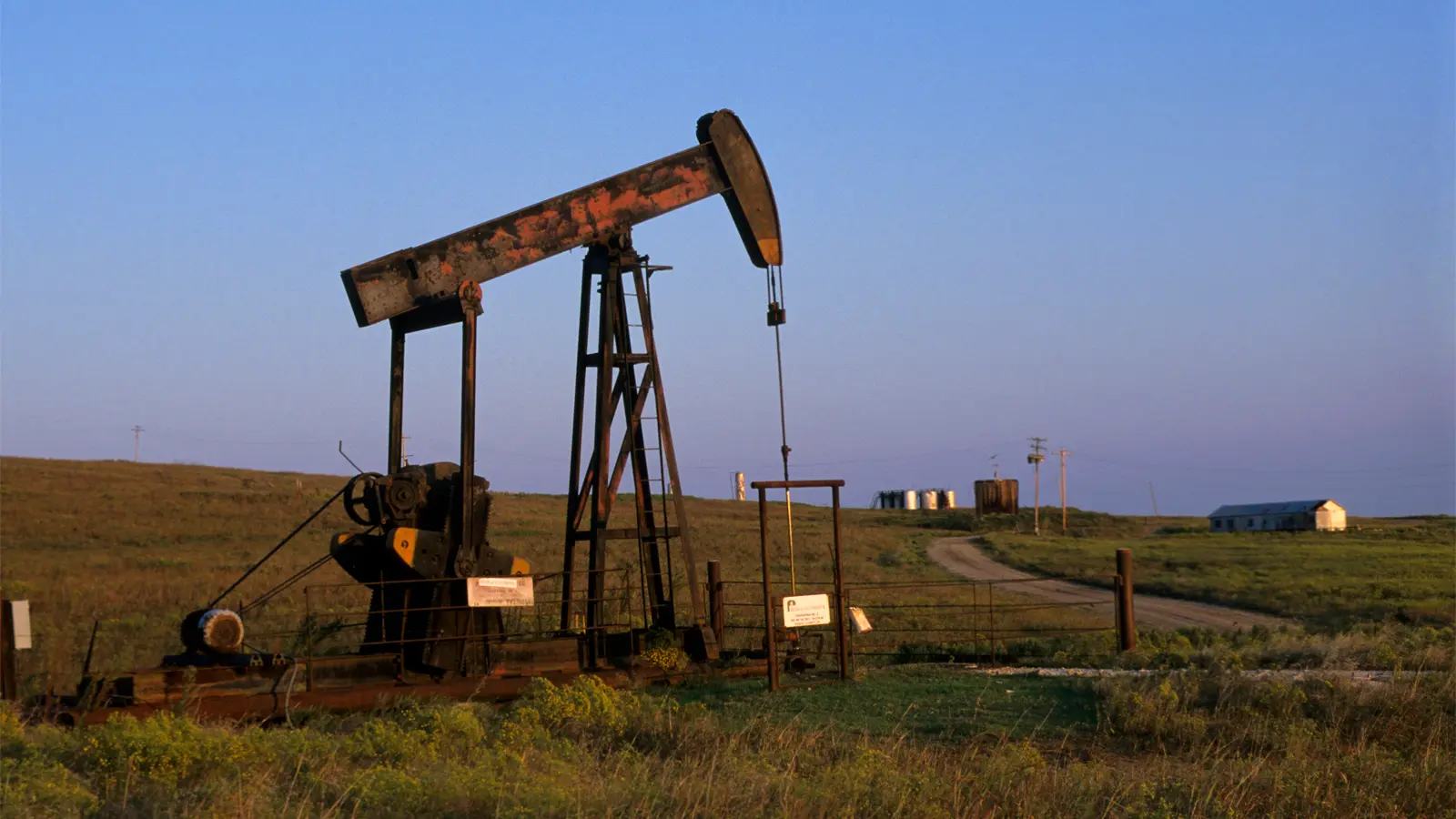
If you walk the streets of Lagos Island today—specifically around Broad Street and Marina—you are walking on the former sites of European "factories" or trading posts. Unlike Badagry, there are no plaques here. The memory has been paved over by the headquarters of multinational banks and the Nigerian Stock Exchange. This is the ultimate irony of Lagos: the very wealth that allowed the city to modernize and expand was harvested from the coastal trade that it now chooses to ignore. The Lagos Coast transitioned from exporting people to exporting oil and finance, but the geographic advantage—the access to the sea—remains the same.
The 1851 Reduction of Lagos and British Intervention
By the mid-19th century, Lagos had eclipsed Badagry in importance. The British, seeking to end the slave trade focused their naval power on Lagos. They recognized that if they could control the mouth of the Lagos lagoon, they could choke off the entire coastal system. This culminated in the Reduction of Lagos in 1851, a naval bombardment that forced the reigning Oba into exile and paved the way for British colonial rule. From this point on, Lagos became a colonial administrative hub, while Badagry began its long descent into a quiet, haunted periphery.
Abolition and the Legacy of the West Africa Squadron
The British Naval Blockade of the Bight of Benin
The end of the slave trade on the Lagos Coast was not a sudden moral awakening; it was a violent, decades-long transition. After the British banned the trade in 1807, the West Africa Squadron began patrolling the waters off Lagos and Badagry. This turned the coastline into a high-stakes game of cat and mouse. Slave ships would hide in the winding creeks of the Lagos lagoons, waiting for a gap in the British patrol to make a dash for the open sea.
Illegal Slave Trading and Clandestine Routes
Between 1810 and 1850, the trade actually intensified in some areas of the Lagos Coast. With the legal markets closed, the price of captives rose, and the business moved further into the shadows. This was the era of the "clandestine trade," where ships were built for speed rather than capacity. The conditions for those held in the Badagry barracoons during this time worsened, as they were often held for months longer than usual while their captors waited for a window to bypass the British blockade.
The Return of the Saro and Amaro to Lagos
When the British eventually seized Lagos and forced the end of the trade, it created a strange new demographic: the Saro and the Amaro. These were formerly enslaved people returning from Sierra Leone and Brazil. They settled primarily in Lagos City, creating a cosmopolitan elite that would eventually lead the push for Nigerian independence. The very system that had sought to erase their identity had, through a bizarre historical arc, produced the class of people who would eventually reclaim the coast.
Preservation vs Erasure: Visible Ruins and Buried Memory
The Tangible Scars of Badagry’s Museums
In Badagry, the past is a museum piece. You can touch the heavy iron chains that bound two men together by the neck. You can see the "spirit attenuating" wells along the Slave Route, where captives were allegedly forced to drink water that had been drugged to make them more submissive. These sites are maintained by the descendants of the very families—both victims and perpetrators—who lived through the trade. There is a heavy, preserved stillness here that feels disconnected from the rest of modern Nigeria.
The Hollow Silence of Modern Lagos City
In Lagos City, the past is a ghost. The city has no Slave Route for tourists. The water at The Marina, which once saw thousands of captives ferried to ships, is now a docking point for ferries and private yachts. The erasure is almost total. This lack of physical evidence creates a different kind of psychological weight—a hollow silence in the midst of a megacity. To find the history in Lagos, you have to look for the "Brazilian" style of the older buildings or the names of the streets which belong to the families of the former traders.
Ethics of Visiting Sites of Tragedy
Visiting the Lagos Coast requires a specific kind of emotional labor. In Badagry, the experience is curated, often leaning into the performative aspects of tragedy for the sake of visitors. In Lagos, the experience is one of searching for something that doesn't want to be found. The contrast highlights a fundamental truth about how we remember: we preserve what we can afford to keep as a relic, and we bury what is too profitable to acknowledge.
Global Connections: From Goree Island to Valongo Wharf
Linking the Lagos Coast to the Atlantic Diaspora
The Lagos Coast was one vital node in a terrifyingly vast global network. To stand in the barracoons of Badagry is to see the mirrored suffering of Goree Island in Senegal. While Goree Island served as a more centralized, fortress-like embarkation point, the Lagos Coast offered a more porous, lagoon-based system of extraction. Both sites, however, shared the same devastating purpose: the industrialization of human displacement.
The Mirror of Plaza Vieja and Valongo Wharf
The human cargo that left the Gberefu Peninsula did not vanish into a vacuum; they reappeared in the plazas and ports of the Americas. Many of those who survived the Middle Passage from the Lagos Coast ended up at the Valongo Wharf in Rio de Janeiro, the busiest slave port in the Americas. Others were auctioned in the colonial squares of Havana, such as Plaza Vieja, where the wealth generated by the Lagos trade built the ornate palaces that tourists admire today. These sites are geologically and historically linked; the stone of Valongo Wharf is the silent destination for the feet that once marched across the sands of Badagry.
Visiting Lagos: How to Explore Its Slave Trade History
Freedom Park
Freedom Park is a must-visit for anyone interested in Lagos's slave trade history. The park is built on the site of a former colonial prison, which was itself constructed on the grounds of a slave market. Visitors can explore the old prison cells, see the remnants of the slave market, and walk through exhibits that tell the story of Lagos's role in the transatlantic slave trade.
The park also hosts cultural events, art exhibitions, and performances that celebrate African heritage and resilience. It is a place of memory, but also of hope—a reminder that the past can be confronted and honored.
Badagry Slave Route
A visit to Badagry is a deeply moving experience. The town's slave route includes several key sites:
- The Vlekete Slave Market: Where captives were bought and sold. The market's ruins still stand, and the air is heavy with the weight of history.
- The Barracoon of Seriki Abass: A preserved slave holding cell where captives were kept before being shipped across the Atlantic.
- The Point of No Return: A memorial on the beach where captives took their last steps on African soil.
- The First Storey Building in Nigeria: Built by returned slaves in the 19th century, it now houses a museum on the slave trade.
Guided tours are available, and the guides—many of whom are descendants of survivors—share stories passed down through generations, bringing the history to life in a way that no textbook can.
The Brazilian Quarter
The Brazilian Quarter in Lagos Island is a living testament to the cultural exchange that took place across the Atlantic. Founded by returned slaves from Brazil in the 19th century, the neighborhood is home to the Afro-Brazilian Museum, which tells the story of these returnees and their impact on Lagos.
The quarter's colorful houses, Catholic churches, and Carnival traditions are a blend of African and Brazilian cultures, a reminder of the resilience and creativity of those who survived the slave trade.
The Waterfront and Slave Jetties
The waterfront areas near Apapa and Tin Can Island were once the jetties where slave ships anchored. While these areas are now bustling with modern shipping activity, they still carry the weight of history. Local fishermen and elders tell stories of the slave jetties, where the water is said to run red with the blood of those who resisted being loaded onto the ships.
Visitors can take boat tours along the waterfront, where guides share the history of the slave trade and point out the spots where captives were last seen on African soil.
Why the Lagos Coast History Still Matters Today
The Lagos Coast is the birthplace of the African Diaspora in the Bight of Benin. The culture of Brazil, Cuba, and the Caribbean was forged in the lagoons of Lagos and the barracoons of Badagry. Every year, thousands of descendants return to the Point of No Return to walk the path of their ancestors in reverse.
But the coast is more than just a site of pilgrimage. It is a warning about the durability of systems. The same coastal geography that made the slave trade possible later made the colonial economy possible, and today makes the global oil economy possible. The names change, but the extraction continues.
As the sun sets over the Atlantic at the end of the Badagry slave route, the Point of No Return arch casts a long, thin shadow over the sand. It is a reminder that the past is not a different country; it is the ground we are standing on. Whether in the frantic streets of Lagos City or the silent ruins of Badagry, the coast remembers what the people have tried to forget.
FAQ
How do I get from Lagos City to Badagry?
The most reliable way to reach Badagry is by private boat from the Lagos Marina or Victoria Island jetties. This water route takes approximately 60 to 90 minutes and bypasses the heavy congestion of the mainland. Traveling by road via the Lagos-Badagry Expressway is possible but highly unpredictable; due to ongoing construction and checkpoints, a 60-kilometer trip can take anywhere from two to five hours.
Are the heritage sites in Badagry authentic?
Most sites, such as the Seriki Abass Barracoon and the Vlekete Slave Market, are located on their original historical grounds. Many of the chains, sun-dried bricks, and architectural layouts date back to the 19th century. However, some commemorative landmarks, like the Point of No Return arch on Gberefu Island, are modern symbolic structures built to facilitate remembrance and tourism.
Is it safe to visit the Lagos Coast slave trade sites alone?
It is strongly recommended to visit these sites with a local guide or as part of a registered tour. While Badagry is generally peaceful, the logistics of crossing the lagoon to Gberefu Island and navigating the rural footpaths are significantly safer and more informative with a professional who understands the local customs and terrain.
How much time should I spend exploring the Lagos Coast?
A comprehensive visit requires at least one full day dedicated to Badagry. If you wish to include Lagos City sites like Freedom Park or the Brazilian Quarter, you should plan for a two-day itinerary. This allows for the slow pacing required to absorb the emotional weight of the sites without the pressure of a rushed commute.
Can I see slave trade ruins in Lagos City?
Physical ruins in Lagos City are almost non-existent as they have been built over by modern infrastructure. Instead of ruins, you will find historical markers and architectural influences. To see preserved barracoons and tangible artifacts, you must travel to Badagry.
Sources
- Slavery and the Birth of an African City: Lagos, 1760–1900 - Kristin Mann (2007)
- The Slave Trade in the Bight of Benin, 1640-1885 - Robin Law (1991)
- Badagry: The Slave Route and the Heritage Museum - UNESCO World Heritage Centre (2004)
- Lagos: A Cultural and Historical Companion - Kaye Whiteman (2012)
- The Trans-Atlantic Slave Trade Database - Emory University / SlaveVoyages.org
- The History of the Yorubas - Samuel Johnson (1921)
- Archaeology of the Atlantic Trade in West Africa - Akinwumi Ogundiran (2022)