The 4,000-Kilometre Brazilian Road That Was Supposed to Conquer the Amazon
On the morning of 9 October 1970, General Emílio Garrastazu Médici stood in a forest clearing on the south bank of the Tocantins River in Pará state, accepted a chainsaw from an aide, and dropped a Brazil nut tree into the dirt. The tree was approximately 150 years old. Behind the president stood his Minister of Transport, several cabinet aides, and a press corps the regime had flown in for the occasion. The phrase Médici used to mark the moment had been prepared in advance and would be repeated for the next decade in every official statement about the highway: uma terra sem homens para homens sem terra, a land without men for men without land.
The phrase was a lie before it was spoken. The territory the Trans-Amazonian Highway would cross contained at least 200,000 indigenous people from dozens of nations. Several of those nations had never been contacted. Within the clearing where the cameras filmed Médici and his chainsaw, the Asurini and the Parakanã were living their ordinary lives a few days’ walk in every direction. Neither group appeared in any official document the regime produced about the road. The president did not mention them. The Minister of Transport did not mention them. The road, when its construction reached their territory in the months that followed, would be the most consequential event in their history and the one that nearly ended both of them.
This is the central fact of the Trans-Amazonian Highway. It was conceived as conquest, and it was executed as the largest infrastructure failure in South American history, and the two facts are not separable. The road killed everything it touched without managing to perform the function for which it was built. It did not deliver Brazilian peasants to viable Amazon farms. It did not reach the Peruvian border. It did not integrate the Amazon economically or project Brazilian sovereignty against any meaningful threat. What it did, with brutal efficiency, was open the world’s largest rainforest to fifty-five years of clear-cutting, cattle ranching, and indigenous depopulation. The highway broke. The damage did not.
The Military Dictatorship and the Brazilian Fear of Losing the Amazon
The Trans-Amazonian Highway was the product of a specific political moment in a specific kind of government. Brazil in 1970 had been ruled for six years by a military regime that had seized power from the democratically elected João Goulart in the coup of 1 April 1964. The generals understood themselves to be saving the country from communism and from the perceived weakness of civilian government. Their governing doctrine, taught at the Escola Superior de Guerra and applied across cabinet decisions, was the Doctrine of National Security: internal development and territorial integration were not policy choices but existential priorities, and any threat to either justified extreme action by the state.
To these officers, the Amazon was a problem in two dimensions. It represented roughly 60 percent of Brazilian national territory and contained only around 4 percent of the Brazilian population. That imbalance was, in the generals’ analysis, a strategic vulnerability. International scientific and environmental organisations had begun to characterise the rainforest as a “global resource” whose protection might require international oversight. The regime read such language as preparation for some form of internationalisation under United Nations auspices. The fear was not entirely irrational; the U.N. had administered other territories under trusteeship. The fear was also wildly inflated. No serious international body was contemplating intervention. The generals proceeded as if they were.
The 1970 Northeastern Drought and the Political Use of a Climate Crisis
The specific trigger came from a thousand miles to the east. The Brazilian Northeast suffered a catastrophic drought in 1970. The Sertão, the semi-arid interior of states like Ceará, Pernambuco, and Piauí, was already the poorest region in Brazil, with land ownership concentrated in the hands of a small rural elite that the military regime had no political appetite to confront. The drought turned chronic rural poverty into acute crisis. Hundreds of thousands of landless families faced starvation. Protests began. The Catholic Church, increasingly aligned with liberation theology in Latin America, began to organise.
Médici and his planners reached for a solution that did not require challenging the Northeastern landowners. They would move the surplus population somewhere else. The Amazon was empty, in the regime’s official conception. The Amazon would absorb the displaced. The road that carried them north would become the spine of a new agricultural Brazil, integrated, productive, sovereign. The Programa de Integração Nacional was launched in June 1970. The Trans-Amazonian Highway was its instrument.
The Slogan That Erased Two Hundred Thousand People
The phrase Médici used at the inauguration, a land without men for men without land, was not a rhetorical flourish. It was a piece of policy. The slogan defined the Amazon as terra nullius, empty land available for distribution, and that definition was load-bearing for everything that followed. If the territory was empty, no consultation with its inhabitants was required. If no consultation was required, no compensation, no negotiation, no rerouting. The slogan made indigenous peoples legally invisible by making them rhetorically invisible. It functioned exactly as it was designed to function.
The 200,000 figure for indigenous population in the highway corridor comes from later anthropological work by FUNAI, the National Indian Foundation, and from the Catholic Church’s Indigenous Missionary Council (CIMI), which began documenting depopulation along the route in the mid-1970s. The actual number was likely higher. Several groups in the central and western sections of the route had never been counted because they had never been reached. The regime knew this and chose its language anyway.
The 1970 Inauguration and the Engineering Reality the Generals Ignored
The plan announced in October 1970 was the most ambitious road construction project in South American history. The Trans-Amazonian Highway would run 4,977 kilometres east to west: from the Atlantic coastal city of Belém, through the gold-mining frontier town of Marabá, west to Altamira on the Xingu River, on to Itaituba on the Tapajós, across the Madeira at Humaitá, through Lábrea, and out to the Peruvian border at Boqueirão da Esperança. The distance was longer than Madrid to Moscow. The terrain was, in places, the wettest and most biologically dense environment on the planet.
Branching off the main spine would be feeder roads, settlement plots laid out in 100-hectare blocks, and “agrovilas” — planned agricultural villages of fifty families each, distributed every ten kilometres along the route. INCRA, the national land reform agency, was tasked with recruiting settlers from the Northeast and managing the colonisation. The total investment was projected at the equivalent of approximately seven billion 1970 U.S. dollars, with construction to be completed in two years.
Why Engineers Knew It Would Not Work
The engineering profession in Brazil understood the project to be unworkable from the day it was announced. The Amazon basin is the largest tropical floodplain on Earth. Annual rainfall in the central Amazon exceeds 3,000 millimetres, concentrated in a wet season that can deliver continuous deluge for weeks at a time. The soils along the planned route are predominantly oxisols and laterites — iron-rich tropical soils that behave as soup when wet and as dust when dry, neither of which provides a stable foundation for a paved highway. Aggregate material for road base — gravel, crushed stone — is essentially absent from most of the route. Bringing it in by truck from outside the basin would have multiplied the cost by an order of magnitude. The regime did not bring it in.
Brazilian engineering consultants warned in writing that an unpaved earth highway across the central Amazon would degrade faster than it could be maintained. Foreign engineers, including consultants from the U.S. Bureau of Public Roads, raised similar concerns. The regime received the warnings and proceeded. The political timetable did not permit delay. The road would be built on the schedule announced, with whatever materials and methods were available, and the long-term consequences would be addressed later. They were not addressed.
The Construction Catastrophe and the Death Toll of the Road Builders
The construction itself was carried out by a combination of Brazilian Army engineering battalions, large private contractors including Andrade Gutierrez and Camargo Corrêa, and the American firm Bechtel under subcontract on specific sections. The labour force was drawn predominantly from the Northeast — the same drought-displaced poor who were meant to be the eventual settlers — supplemented by conscripted soldiers and migrant workers recruited at exploitative rates. Construction proceeded in parallel along multiple sections, with bulldozers and chainsaws clearing a 100-metre right of way and earth-moving equipment grading the bare ground into something that could be called a road.
The conditions were lethal. The work took place in unprotected jungle in temperatures that routinely exceeded 35°C with near-total humidity. Mosquito-borne illness was endemic. Workers slept in open tents along the roadbed. Medical evacuation, when it existed at all, took days.
Malaria, Yellow Fever, and the Bodies Buried Along the Roadbed
Malaria was the leading cause of death among highway workers. Yellow fever returned in epidemic waves along the route, killing workers who had no immunity. Snake bite was the second-leading documented cause of death. Industrial accidents — bulldozer rollovers, falling trees, chainsaw injuries — accounted for a smaller but significant share. The official Brazilian government figure for the construction-phase death toll is “several hundred.” Independent reconstructions by Brazilian historians working from labour records, regional medical reports, and oral histories collected in the 1990s place the actual number between 2,000 and 5,000.
The bodies were buried where they fell. Workers who survived and were interviewed decades later by researchers at the University of Brasília described burial trenches dug into the road shoulder, sometimes filled the same day. Men disappeared from work crews and were not formally recorded as deceased; they were simply removed from the next morning’s payroll. There were no funerals. There were no headstones. There is no monument to the workers along the highway today. The road itself is the monument, because the workers are under it.
One of the documented oral histories, recorded by the historian Ricardo Folhes from a former labourer named Jeremias dos Santos in the early 2000s, describes a single week in the construction camp near Altamira in 1972 during which malaria carried off nine men from a crew of forty. The bodies were collected each morning by the camp foreman, loaded onto a truck, driven a short distance up the road, and buried in a single trench. The names of those nine men appear in no parish record and on no government list. Their families in the Northeast received, in some cases, a small payment and a letter notifying them of the death. In other cases they received nothing at all.
The First Stretch Opens: Belém to Estreito, 1972
The eastern section of the Trans-Amazonian Highway was officially opened on 27 August 1972, less than two years after the chainsaw ceremony. Médici flew over the route in a military aircraft and pronounced the project a triumph. The road from Belém to Estreito, approximately 1,000 kilometres, was open to traffic.
The opening was theatrical. The road was unpaved earth. Within months of the first wet season, the surface broke apart. Trucks bogged down to their axles. Sections of the road shoulder collapsed into the surrounding terrain. The Brazilian engineering profession’s predictions, delivered in writing two years earlier, began to be fulfilled in exactly the manner predicted. By the end of 1973, large stretches of the inaugurated highway were impassable for weeks at a time. The regime continued to call it a national highway. Field reports from regional INCRA offices, which began to circulate internally in 1974 and 1975, described what the regime was calling a national highway as a degraded dirt track over which agricultural commerce was effectively impossible.
This was the moment at which the project’s failure as an engineering proposition became inescapable. The regime responded by ceasing to discuss it.
The Asurini, the Parakanã, and the Genocide of First Contact
The cost of the highway to the indigenous peoples of the Brazilian Amazon is the part of the story that has been most thoroughly documented and least acknowledged in the official record. The territory the road crossed contained dozens of indigenous nations: the Asurini do Tocantins, the Parakanã, the Araweté, the Suruí, the Cinta Larga, the Kayapó, the Arara, the Juruna, the Kraô, and a number of smaller and less-documented groups, some of which the road encountered before anthropologists or FUNAI could properly identify them.
FUNAI, the National Indian Foundation, had personnel in the field along the route. Its capacity was overwhelmed by the speed of the construction and by the political pressure not to delay the project. The agency’s mandate to protect indigenous peoples was, in practice, subordinated to the regime’s commitment to building the road on schedule. Some FUNAI agents made heroic efforts. The institution did not.
The Parakanã Contact Disaster of 1971
The Parakanã were a Tupi-Guarani-speaking group living in the upper Tocantins watershed, in territory that the central section of the Trans-Amazonian was scheduled to cross in 1971 and 1972. They had been in intermittent contact with Brazilian society for several decades but had maintained substantial distance from settled populations and had no immunity to most of the common European-derived infectious diseases circulating in Brazilian frontier communities.
First sustained contact between the Parakanã and highway construction crews occurred in 1971. The mechanics of disease transmission did the rest. Within six weeks of one documented contact event in mid-1971, an influenza outbreak swept one Parakanã village and killed an estimated 70 percent of its inhabitants. Subsequent waves of measles, tuberculosis, and respiratory infections through the early 1970s reduced the total Parakanã population from approximately 400 individuals at first contact to fewer than 100 by 1975. The survivors were resettled by FUNAI onto a smaller territory. Their language, their kinship networks, and their seasonal hunting and gathering patterns were broken beyond reconstruction.
The Parakanã survived. They are still recognised today as a distinct people, with a recovered population of around 1,300. The recovery is a credit to the survivors. It is not a credit to the regime that nearly destroyed them.
The Pattern Repeated: Eight Thousand Dead Across Two Decades
The Parakanã disaster was the most documented case but not the most severe. Anthropologists working with FUNAI and CIMI through the 1970s and 1980s recorded similar contact-driven depopulations among the Araweté, the Asurini do Xingu, the Arara, and several smaller groups. The Arara, in particular, suffered population losses similar to the Parakanã’s, with an estimated 70 percent mortality in the first two years following sustained contact with road construction.
The cumulative documented indigenous death toll from highway-driven contact, across the two decades following the road’s opening, is approximately 8,000. The figure comes from CIMI’s published surveys, cross-referenced with FUNAI’s contact records and with academic anthropological work, principally by Eduardo Viveiros de Castro at the National Museum in Rio de Janeiro. The actual figure is higher. Several groups recorded in the regional ethnographic literature in the 1960s and early 1970s do not appear in any subsequent census because there was nobody left to count. Two and possibly three small groups in the central Tocantins basin appear to have been extinguished entirely between 1971 and 1980 without ever being formally documented as nations. They are recorded in the academic literature today as “unidentified” populations whose existence is inferred from the testimony of surviving neighbouring groups.
What the Brazilian state achieved on this stretch of road, in the name of national integration, was the partial or complete erasure of dozens of distinct human cultures. The work was done not by deliberate killing but by the introduction of bulldozers, work crews, and disease into territories whose inhabitants had no defences against any of the three.
The Failure of the Settlement Colonies and the Abandonment of the Western Sections
The settlement programme that justified the entire enterprise collapsed faster than anyone outside the planning offices had expected.
The 100,000 Families That Were Supposed to Farm the Amazon
INCRA’s 1970 plan called for 100,000 families to be settled along the highway over five years. The families would receive 100-hectare lots — generous holdings by Northeastern standards — along with subsidised housing materials, agricultural extension services, access to credit, and integration into a road-based commercial network. The agrovilas would group fifty families together at ten-kilometre intervals. Schools, clinics, and markets would follow.
By 1974, four years into the programme, INCRA had managed to settle approximately 7,000 families. By 1980 the figure had risen modestly but most of the original settlers had already left. The actual number of families still resident on their original highway plots by the end of the decade was, according to INCRA’s own internal review, fewer than 4,000. The 100,000-family vision had failed by a factor of more than twenty-five.
Why Amazonian Soil Will Not Sustain Smallholder Farming
The agricultural failure was, like the engineering failure, predictable. Amazon rainforest soils are extraordinarily poor in nutrients. The biological wealth of the rainforest sits in the canopy and in the rapid recycling of organic matter between living vegetation and the thin upper layer of leaf litter. Clear the canopy, burn the litter, and the soil that remains will support agriculture for two or perhaps three growing seasons before yields collapse. This is the same biological reality that had defeated Fordlândia, Henry Ford’s American utopian rubber colony on the Tapajós River, forty years earlier. The Brazilian regime knew about Fordlândia. The Brazilian regime proceeded anyway.
The settler families who arrived from the Northeast were given crops, seed, and basic training, and were instructed to plant rice, manioc, and beans. The first harvest was reasonable. The second was thin. By the third growing season most lots were producing nothing the family could live on. The settlers had no capital reserves to weather the failure and no ability to relocate. The road that was supposed to carry their produce to market was, in most central sections, impassable for half the year. Without functioning transport, even a successful harvest could not reach a buyer. The families who could leave did. The families who could not leave became extremely poor in a place that had no infrastructure to support poverty.
The land they abandoned was not returned to forest. It was bought up — often through fraudulent paperwork — by larger cattle operations, which converted the cleared plots into low-density pasture. This was the pattern that would dominate the central Amazon for the next fifty years. The settlers cleared the land, the settlers failed, the ranchers took over. The rainforest did not return.
The Road That Never Reached Peru
The geographical failure was even cleaner. By 1974 the regime had run out of money. The combined cost of construction, subsidies to settlers, infrastructure for the new colonies, and FUNAI’s belated attempts to manage the indigenous catastrophe had vastly exceeded the original budget. Inflation in Brazil was accelerating. The political utility of the project, which had peaked in 1971 and 1972, was declining as journalists and academics began to document the failures.
The regime quietly scaled back. The western sections of the route, from Humaitá onward, were progressively abandoned. Construction halted. Existing graded stretches were left to deteriorate. By 1975 the official map of the Trans-Amazonian Highway and the actual physical road had diverged: the map continued to show a national highway running to the Peruvian border, while on the ground the road simply ended in the middle of the rainforest at the edge of where the bulldozers had last operated.
The final westernmost segments to Boqueirão da Esperança, on the Peruvian frontier, have never been built. The Trans-Amazonian Highway, fifty-five years after its inauguration, terminates somewhere west of Lábrea in Amazonas state, in country where the road becomes a rough track, then a footpath, then disappears entirely. The eastern Atlantic terminus exists. The western Pacific terminus does not. The road that was supposed to cross the continent crosses about two-thirds of it.
The BR-230 Today and the Long Wound Through the Amazon
The Trans-Amazonian Highway is still officially designated a federal highway and is still officially in service. The reality on the ground varies by section.
The eastern segments, from Belém through Marabá to Altamira, have been paved over the past three decades in stages and now carry heavy traffic — logging trucks, cattle transporters, settler buses, the supply chain of the gold mines around Eldorado dos Carajás. These sections function as a road, although the accident rate is among the highest in Brazil. Truckers describe the stretch from Marabá to Altamira as one of the most dangerous extended drives in South America, with frequent fatal collisions, organised crime along the corridor, and police presence that fluctuates with the political season.
The central segments, from Altamira west through Itaituba to Humaitá, are partly paved and partly dirt. They are passable in the dry season and unreliable in the wet. Sections wash out annually and are repaired with whatever federal or state money is available, which is rarely enough. The communities along these stretches — small towns built on the agrovila grid that has long since ceased to exist as a coherent programme — live with the road’s seasonality as a basic condition of life. Goods become unavailable. Travel becomes impossible. The communities wait for the dry season to resume contact with the outside.
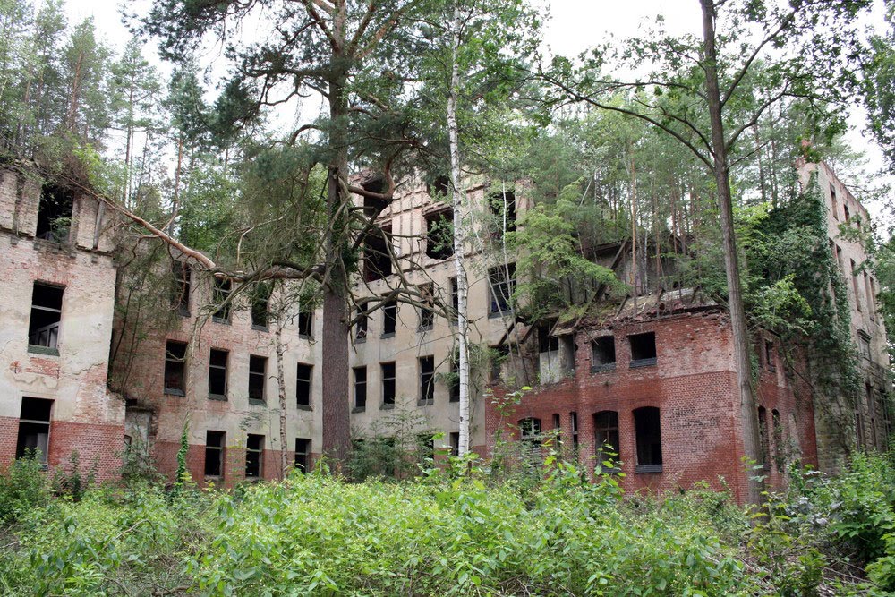
The western segments, from Humaitá toward Lábrea and the never-completed Peruvian terminus, are essentially gone. They exist on maps. They exist as single-lane tracks in the satellite imagery. They are not maintained, they are not regularly travelled, and they connect nothing of significance to anything else. The forest is gradually recovering them. In another fifty years, without active reconstruction, they may not be visually distinguishable from the surrounding terrain.
What the road has continued to produce, even after its abandonment as an integrated highway, is deforestation. The BR-230 corridor and its feeder roads, especially the BR-163 from Cuiabá to Santarém and the BR-364 toward Acre, define the highest-deforestation zone on Earth and have done so for half a century. The road provided access. The road provided the spine. Loggers, ranchers, soy farmers, and gold miners followed. The Brazilian state, regardless of which government has held power in Brasília, has lacked either the capacity or the will to enforce environmental law along the corridor at the scale required. The Amazon has lost roughly 17 percent of its original forest cover since 1970. The bulk of that loss has occurred along the highway and its tributaries.
Standing at the side of BR-230 in mid-afternoon, somewhere west of Altamira in the dry season, the visitor sees a two-lane paved road through cleared cattle pasture. The pasture extends as far as the eye can travel. There is no forest in immediate view. There may be, in the distance, the green wall of a remnant tract of standing canopy. The trucks pass at high speed and do not stop. The road continues west, and the cleared pasture continues with it, and at some point in the next few hundred kilometres the road will degrade and the cleared pasture will give way to broken forest fragments and abandoned settler plots, and the road will continue to degrade and continue to push west, and somewhere far ahead, in country the road never quite reached, the Peruvian border lies under intact rainforest that the highway never managed to open. The road did its work. It just did not do the work it was designed for.
Frequently Asked Questions About the Trans-Amazonian Highway
Where does the Trans-Amazonian Highway go?
The Trans-Amazonian Highway, designated BR-230, was planned to run 4,977 kilometres from the Atlantic coast at Cabedelo in Paraíba state, through Belém in Pará, across the Brazilian Amazon to the Peruvian border at Boqueirão da Esperança in western Acre. The eastern sections from Belém to Altamira are paved and in active use. The central sections are partially paved and seasonally impassable. The western terminal sections to the Peruvian border have never been completed and the highway effectively ends in Amazonas state west of Lábrea.
Who built the Trans-Amazonian Highway and when?
The road was launched by the Brazilian military dictatorship under President Emílio Garrastazu Médici on 9 October 1970 and was constructed between 1970 and 1975 by a combination of Brazilian Army engineering battalions and private contractors including Andrade Gutierrez, Camargo Corrêa, and the American firm Bechtel. The construction labour force was drawn principally from the Brazilian Northeast and from conscripted soldiers. The eastern section opened officially in August 1972. Construction in the western sections was abandoned by the mid-1970s.
How many people died building the highway?
Official Brazilian government figures place the construction-phase death toll at several hundred. Independent reconstructions by Brazilian historians, based on labour records, regional medical reports, and oral histories from surviving workers, place the actual number between 2,000 and 5,000. The leading causes of death were malaria, yellow fever, and other tropical diseases, snake bite, and industrial accidents. Most bodies were buried in unmarked trenches along the roadbed itself. There is no monument to the workers.
What was the impact on indigenous peoples?
The territory the highway crossed contained dozens of indigenous nations, including the Parakanã, Asurini, Araweté, Arara, Suruí, Cinta Larga, and Kayapó. Several groups had no prior sustained contact with Brazilian society. First contact during highway construction triggered catastrophic epidemics — influenza, measles, tuberculosis, respiratory infections — that killed an estimated 8,000 indigenous people across the following two decades. Some smaller groups appear to have been entirely extinguished without formal documentation. The 8,000 figure is conservative; the actual death toll was higher.
Why did the settlement programme fail?
The Brazilian land reform agency INCRA had planned to settle 100,000 families along the highway over five years. By 1980 fewer than 4,000 families remained on their original plots. The failure had multiple causes, but the principal one was agricultural: Amazon rainforest soils, once cleared, support smallholder farming for only two or three growing seasons before yields collapse. Settlers had no capital to weather crop failure, no functioning road infrastructure to bring their harvests to market in the wet season, and no support from a state that had lost interest in the project by 1974. Most walked away. The cleared land was bought up by cattle ranchers.
Is the Trans-Amazonian Highway still in use today?
Yes, in fragments. The eastern paved sections from Belém through Marabá to Altamira are heavily trafficked and are among the most accident-prone highways in Brazil. The central sections are partly paved and seasonally impassable in the wet season. The westernmost sections to the Peruvian border have never been completed and the road, for practical purposes, ends in remote Amazonas state west of Lábrea. The highway corridor remains the spine of the highest-deforestation zone on Earth and has been for fifty years.
Sources
The Last Forest: The Amazon in the Age of Globalization — Mark London and Brian Kelly (2007)
Cutting the Wire: The Story of the Landless Movement in Brazil — Sue Branford and Jan Rocha (2002)
From the Enemy's Point of View: Humanity and Divinity in an Amazonian Society — Eduardo Viveiros de Castro, University of Chicago Press (1992)
Os Parakanã: índios da bacia do Tocantins — Carlos Fausto, EDUSP (2001)
Brazil's Highway to Conquest: The Trans-Amazonica — Shelton H. Davis, in Latin American Perspectives (1977)
Victims of the Miracle: Development and the Indians of Brazil — Shelton H. Davis, Cambridge University Press (1977)
CIMI Annual Reports on Violence Against Indigenous Peoples in Brazil, 1972–1990 — Conselho Indigenista Missionário
The Brazilian Military Regime and the Amazon: National Security Doctrine and Frontier Expansion — Bertha Becker, in Hispanic American Historical Review (1990)
FUNAI internal contact records, Parakanã and Asurini, 1971–1980 — Fundação Nacional do Índio archives
Estrada da Morte: Histórias da Transamazônica — Lúcio Flávio Pinto (2003)
Oral history interviews with former Trans-Amazonian highway workers — Ricardo Folhes, Federal University of Pará research project (early 2000s)
INCRA Internal Review of the Programa de Integração Nacional Colonisation Programme, 1980 — Instituto Nacional de Colonização e Reforma Agrária