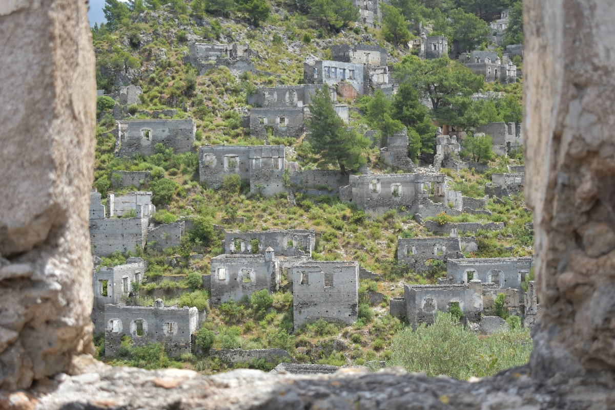
Surveyors moved along the old Western Front through 1919 with coloured pencils, grading French soil by how much of it could be brought back. Land shaded green would return to the plough within a season. Yellow and blue would take longer. Around Verdun the pencils went red, and the red carried a formula the commission wrote out in full: damage to property, one hundred per cent; damage to agriculture, one hundred per cent; impossible to clean; human life impossible. More than 1,200 square kilometres of France were classified that way. Some of the people it applied to had already walked home. The inhabitants of Fleury-devant-Douaumont came back that spring to a hillside where they could not locate their own houses — no walls, no foundations, no lane, nothing to measure from.
France did something after 1918 that no industrial state had done before: it wrote off a piece of its own territory permanently. The decision was not sentimental and not commemorative. It was arithmetic. Clearing the ground would cost more than the ground was worth, and would kill people in the process, so the state drew a boundary, moved the survivors out, forbade farming and building and forestry inside the line, and planted trees on top to hold the poisoned soil in place.
Everything that has happened since follows from that decision. The forest above Verdun is not a natural woodland; it is a lid. The nine villages that vanished are still administrative entities with mayors and councils, because France chose to keep them legally alive rather than absorb them into their neighbours. And the war itself has an official end date of 11 November 1918 and a practical one that the French civil protection agency estimates at somewhere between three hundred and seven hundred years from now.
Why France Declared the Zone Rouge Unfit for Human Life in 1919
The Survey That Classified 1,200 Square Kilometres as Beyond Repair
The scale of the problem was set by the way the war was fought. Artillery accounted for the overwhelming majority of casualties on the Western Front, and the front barely moved for four years, which meant the same narrow strip of ground absorbed shellfire continuously from 1914 to 1918. At Verdun alone, roughly 60 million shells fell across 303 days in 1916. Something like a quarter of them failed to detonate and stayed in the earth, armed.
French surveyors worked outward from that reality. The devastated regions were mapped and graded, and the red category was reserved for land where recovery was judged impossible rather than merely expensive. The classification stretched from the Belgian border down through the Somme and the Aisne to the Meuse, in fragments rather than a single block, following the line of the trenches.
The legal consequences were absolute. Housing, agriculture and forestry were all prohibited inside the red boundary. Owners were expropriated and compensated. Land that families had farmed for centuries stopped being farmland by decree, and the decree has never been fully lifted.
The Nine Villages That Died for France Around Verdun
Nine communes around Verdun were destroyed past the point of rebuilding: Beaumont-en-Verdunois, Bezonvaux, Cumières-le-Mort-Homme, Douaumont, Fleury-devant-Douaumont, Haumont-près-Samogneux, Louvemont-Côte-du-Poivre, Ornes and Vaux-devant-Damloup. France declared them morts pour la France — died for France — the same formula applied to soldiers killed in action, extended for the first and only time to places.
Three were eventually rebuilt and function as ordinary communes today. Six were not, and remain unpopulated.
The decision to keep them on the books rather than merge them into surviving neighbours was deliberate. Absorbing a destroyed village into the next commune would have removed its name from the map permanently, which the state judged a second death. Keeping it as a legal entity with no inhabitants preserved the name at the cost of an administrative absurdity that has now run for over a century.
Life and Death in the Destroyed Villages of the Meuse
Fleury-devant-Douaumont: The Village That Changed Hands Sixteen Times
Fleury sat on the slope between Fort Douaumont and Verdun, which made it a hinge in the battle rather than a bystander. Roughly 400 people lived there before 1916, farming and working the quarries. Between June and August that year the village was taken and retaken sixteen times.
By the sixteenth exchange there was no village to take. Contemporary accounts describe the position as a set of coordinates rather than a place — the fighting continued over ground where the buildings had been reduced to a colour change in the mud. The bodies of the men who died there were absorbed into the same churn. The Douaumont Ossuary, a few hundred metres away, now holds the remains of around 130,000 soldiers who could not be identified, French and German mixed together because there was no longer any way to separate them.
What stands at Fleury today is a set of low posts among the trees. Each one is marked with what used to be there: the bakery, the grocer, the farm, the school. The posts are set on the map coordinates rather than on visible foundations, because there are no visible foundations. A chapel was built on the site in 1979. The ground around it still rises and falls in the shape the shells left.
Mayors and Councils for Villages With No Residents
Each of the six unpopulated communes has a municipal council of three members, appointed by the prefect of the Meuse rather than elected, because there is nobody living inside the commune to vote. One of the three serves as mayor.
The role is real. These mayors maintain the chapels and the marker posts, receive visiting delegations, oversee the commemorations, and sign the paperwork that any French commune generates. They live elsewhere. They are, in a strict administrative sense, the mayors of places with a population of zero, and France has been appointing them without interruption since the 1920s.
The arrangement produces small collisions with the modern French state that nobody has ever bothered to resolve. Census forms arrive. Communal budgets are set. A commune that consists entirely of forest, craters and a chapel continues to exist in the national register exactly as Lyon does, and the difference between them is only a number.
The Forest Planted to Cover the Verdun Battlefield
Austrian Black Pine and the Making of the Forêt Domaniale
The trees around Verdun were planted, and the choice of species was dictated by what the ground could still support. In the worst areas the topsoil had been blown away entirely, leaving something close to bare rock. Black pine tolerates poor thin soil better than almost anything else, and consignments of Pinus nigra arrived from Austria as part of the reparations settlement — a defeated power’s trees, planted to cover the ground its shells had destroyed.
Planting served a practical purpose before a symbolic one. Bare churned earth erodes, and erosion moves buried shells toward the surface and into watercourses. A root system holds the ground still. The forest was, in the most literal sense, a cap.
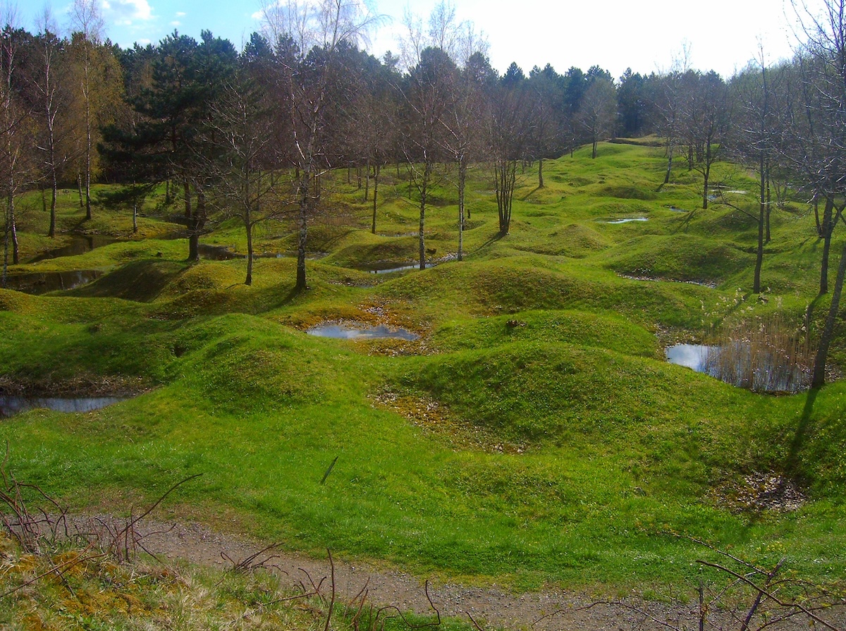
The unintended result is that the battlefield survived. Farming would have levelled the craters and the trench lines within a decade. Forestry preserved them, and the terrain under the pines at Verdun still holds the shape of 1916 — shell holes overlapping shell holes, the collapsed lines of trenches, concrete shelters pushing out of the leaf litter. Very little of the Western Front elsewhere looks like this, because almost everywhere else the plough came back.
What Grows in the Zone Rouge and What Refuses To
Vegetation returned faster than anyone expected across most of the zone. Grasses, briar and scrub were established within a few years of the armistice, and historians of the battlefield have noted how quickly the ground turned green over ordnance that had not moved at all.
The exceptions are precise and they are chemical. The French botanist Georges Parent surveyed the flora of the region over decades and described the worst sectors as a biological desert, an assessment that has held up. Soil in those pockets carries lead, mercury, zinc, arsenic and residues from a century of decaying explosives. Plant diversity drops sharply. Trees that do grow accumulate metal in their tissue, and shrapnel fragments embedded in trunks make timber from parts of the zone commercially useless and physically dangerous — a saw blade meeting steel at speed can shatter and kill the operator.
Wild boar in the region have been found with elevated lead levels in the liver. The animals root and dig, which puts them in more direct contact with the contaminated layer than anything else living there.
Place à Gaz: The Most Poisoned Ground in France
Burning Germany’s Chemical Shells in the Spincourt Forest
The single worst piece of ground in France was created after the fighting stopped, by people cleaning up. In a clearing in the Spincourt forest north-east of Verdun, contractors working for the French authorities spent much of the 1920s destroying captured German chemical shells by burning them. The method was straightforward: stack the munitions, add fuel, ignite, repeat. Arsenic-based agents made up a large share of the German chemical stockpile, and arsenic does not burn away. It stays.
Nobody at the time treated this as a problem worth studying. The shells were destroyed, the contract was fulfilled, and the clearing went back to being a clearing. Local people continued to use the Spincourt woods for forestry and hunting for the next eighty years. At some point hunters built themselves a hut in the clearing to eat lunch in and store game. None of them was ever the subject of a medical study.
The Soil Study That Closed the Site in 2012
Researchers sampled the clearing in the mid-2000s and found arsenic at up to 176 grams per kilogram of soil — roughly 17 per cent arsenic by weight, tens of thousands of times the level in ordinary ground. Groundwater in the area carried arsenic at hundreds of times the tolerable threshold. Almost nothing grows in the clearing. The site is known locally as the Place à Gaz, and it is the most contaminated square of land in France by a wide margin.
Access was formally prohibited in 2012, roughly ninety years after the burning started and eight after the measurements were published. The clearing is now ringed with razor wire.
The chronology is the part worth holding onto. The war produced the shells; the peace produced the poison. Everything lethal about that clearing was created by the effort to make the region safe, carried out competently by the standards of the time, and left to sit under a hunters’ lunch hut for four generations.
The Iron Harvest and the Démineurs Who Clear It
How Much Unexploded Ordnance France Recovers Each Year
Farmers along the old front still turn up shells every spring, in numbers that make the practice routine rather than remarkable. The material comes to the surface through frost heave and ploughing, gets stacked at the field edge, and is collected. The French call the annual recovery the iron harvest, and it runs to hundreds of tonnes a year across the country.
The densities involved are hard to picture. Trials conducted in 2005 and 2006 found up to 300 shells per hectare in the top fifteen centimetres of soil in the worst sectors — three hundred pieces of live ordnance in the depth a plough reaches, in a square of ground a farmer could walk across in twenty seconds. The Battle of the Somme ground carries much of this burden, and unlike the Verdun hills it is farmed intensively, which puts a tractor over it several times a year.
Chemical shells are the serious problem. They corrode, they cannot be blown in place safely, and they require dedicated destruction facilities that France spent decades not building.
The Men Killed Clearing a War That Ended in 1918
France created a national bomb disposal service in 1945, by an order signed under de Gaulle, and its first head was Raymond Aubrac — a Resistance leader who had survived Gestapo custody and now took charge of sending volunteers into minefields. The immediate task was the ordnance of the Second World War. The First World War’s shells came with the territory and have never stopped coming.
Since 1945, 621 démineurs have been killed in service, and thousands more injured. The figure covers all of the service’s work, and it is a casualty list from a peacetime organisation of a few hundred people.
France currently employs around 333 démineurs across 26 centres. Every one of them is trained at a single facility on the Meurthe-et-Moselle border, between Flirey and Essey-et-Maizerais, at a site called Mort-Mare. The name predates the school. Mort-Mare was a 1914–18 battlefield, and France teaches bomb disposal on top of it.
The Zone Rouge Today: Seven Centuries of Clearance Remaining
Shrinking the Red Zone and the Land Released Too Early
Most of the original red zone has been returned to use. The 1,200 square kilometres of 1919 have come down to somewhere between 100 and 170, concentrated around Verdun where the land is steeper, more remote and worse damaged than anywhere else on the front.
Some of that release happened too fast. Clearance before the 1970s meant removing visible ordnance and destroying it locally, without regard for what leached into the soil and water afterward. Land was certified and handed back on the strength of surface surveys. The Place à Gaz sat inside a zone people were permitted to use.
The current estimate from the Sécurité Civile is that clearing France completely at present rates would take between three hundred and seven hundred years. The estimate has been quoted for long enough that it now functions less as a plan than as an admission.
The Accidental Wilderness Left Behind
Removing people from a landscape for a hundred years produces results that no conservation programme could fund. The Zone Rouge holds mature forest, undisturbed watercourses and populations of boar, deer and raptors on ground that was farmed continuously for a thousand years before 1914. Ecologists have studied it as an unplanned experiment in what happens when agriculture simply stops.
The wilderness is real and the reason for it is not restorative. This is not land that was protected. It is land that was made too dangerous to enter, and the wildlife moved into a space cleared by the same shells that are still underneath it.
Visiting the Zone Rouge and the Destroyed Villages of Verdun
The accessible core of the Zone Rouge sits north of Verdun in the Meuse, and most of it can be visited freely on marked paths. The Mémorial de Verdun at Fleury-devant-Douaumont, the Douaumont Ossuary, Fort Douaumont and Fort Vaux form a compact circuit reachable by car in a morning, and the destroyed villages are signposted from the D913. Verdun itself is about three hours east of Paris.
Staying on the paths is the entire safety brief, and it is not decorative. Ordnance remains in the ground everywhere off the marked routes, metal detecting is illegal throughout the zone, and picking anything up is illegal and stupid in roughly equal measure. Certain sectors, the Place à Gaz among them, are fenced and prohibited outright.
The forest floor is the thing most visitors are unprepared for. The ground does not undulate; it pits, continuously, crater into crater, for kilometres, under a canopy of planted pine that makes the light flat and the sound dead. Walking it takes longer than the distance suggests because the surface never levels out.
Fleury rewards slow attention more than the forts do. The marker posts stand in the trees at the spacing of a village street, naming a bakery and a school where there is only leaf litter, and the effect is closer to reading a list than seeing a ruin. France preserved Oradour-sur-Glane as a ruin after 1944 by deliberate national decision, keeping the burnt walls and the rusted cars exactly as the SS left them. The Meuse villages got posts instead, for the plain reason that nothing survived to preserve. At Chemin des Dames, the village of Craonne was rebuilt a few hundred metres downhill from its original site, which is the compromise the nine villages of Verdun were never offered.
The comparison that clarifies the Zone Rouge best lies across the Belgian border. Ypres was shelled into powder and then rebuilt stone by stone, medieval cloth hall and all, as a deliberate refusal to let the destruction stand. Sixty miles south, France looked at similar ground and decided the opposite — that some of it could not be recovered and should not be attempted, and that the honest response was to fence it, name it, and wait.
A century on, the waiting has produced a forest, six villages that exist only on paper, several hundred dead bomb disposal officers, and a clearing in the Spincourt woods where the soil is one-sixth arsenic. The shelling stopped in 1918. Nothing else did.
Frequently Asked Questions About the Zone Rouge
What is the Zone Rouge in France?
The Zone Rouge is a chain of non-contiguous areas across northeastern France that the government classified as uninhabitable after the First World War. Surveyors grading the devastated regions in 1919 assigned the red category to land judged impossible to clean, with total damage to property and agriculture and, in the official wording, human life impossible. Housing, farming and forestry were prohibited inside the boundary and owners were expropriated. The zone runs in fragments from the Belgian border through the Somme and the Aisne to the Meuse, following the line of the trenches.
How big is the Zone Rouge today?
The original classification covered more than 1,200 square kilometres. Successive clearance has reduced the restricted area to somewhere between 100 and 170 square kilometres, concentrated around Verdun where the terrain is steeper, more remote and more heavily damaged than elsewhere on the front. Much of the released land was certified on the strength of surface surveys before the 1970s, without regard for contamination that had leached into soil and groundwater. The French civil protection agency estimates that clearing the country completely at current rates would take between three hundred and seven hundred years.
Which French villages were destroyed and never rebuilt?
Nine communes around Verdun were destroyed beyond rebuilding: Beaumont-en-Verdunois, Bezonvaux, Cumières-le-Mort-Homme, Douaumont, Fleury-devant-Douaumont, Haumont-près-Samogneux, Louvemont-Côte-du-Poivre, Ornes and Vaux-devant-Damloup. France declared them morts pour la France, the formula normally reserved for soldiers killed in action. Three were eventually rebuilt as ordinary communes. The other six remain unpopulated and are administered by three-member councils appointed by the prefect of the Meuse, one of whom serves as mayor.
Is the Zone Rouge still dangerous?
Unexploded ordnance remains throughout the zone and comes to the surface each year through frost and ploughing, in a seasonal recovery the French call the iron harvest. Trials in 2005 and 2006 found up to 300 shells per hectare in the top fifteen centimetres of soil in the worst sectors. Soils carry lead, mercury, zinc and arsenic from a century of decaying munitions, and wild boar in the region have shown elevated lead levels. Metal detecting is illegal throughout the zone and marked paths exist for a reason.
What is the Place à Gaz near Verdun?
Place à Gaz is a clearing in the Spincourt forest north-east of Verdun where contractors spent much of the 1920s destroying captured German chemical shells by burning them. Arsenic-based agents made up a large share of the German chemical stockpile and did not burn away. Soil sampling in the mid-2000s found arsenic at up to 176 grams per kilogram, roughly 17 per cent by weight, making it the most contaminated ground in France. The site was fenced and formally closed to the public in 2012, having been used for forestry and hunting for the preceding eighty years.
Can visitors go to the Zone Rouge?
The accessible core of the zone lies north of Verdun in the Meuse and can be visited freely on marked paths. The Mémorial de Verdun at Fleury-devant-Douaumont, the Douaumont Ossuary, Fort Douaumont and Fort Vaux form a compact circuit, and the destroyed villages are signposted from the D913. Certain sectors including Place à Gaz are fenced and prohibited outright. Staying on marked routes is the whole of the safety guidance and it is not a formality.
Sources
After the Ruins: Restoring the Countryside of Northern France after the Great War — Hugh Clout (1996)
Verdun: The Longest Battle of the Great War — Paul Jankowski (2013)
The Price of Glory: Verdun 1916 — Alistair Horne (1962)
Walking Verdun: A Guide to the Battlefield — Christina Holstein (2009)
Islands of Abandonment: Nature Rebounding in the Post-Human Landscape — Cal Flyn (2021)
Exposure Assessment of a Burning Ground for Chemical Ammunition on the Great War Battlefields of Verdun — Bausinger, Bonnaire and Preuß, Science of the Total Environment (2007)
Une question vitale en instance depuis 80 ans : le déminage — Sénat, Rapport d’information (2000)
Le déminage de la France après 1945 — Chemins de Mémoire, Ministère des Armées (2015)
Les démineurs en France 1944–1947 — Françoise Sappin, Ministère de l’Écologie (2015)
Les Villages Détruits de la Meuse — Conseil Départemental de la Meuse (2016)
The Nine Ghost Villages of Northern France — Melissa Banigan, BBC Travel (2018)
Red Zone — National Geographic Education (2019)